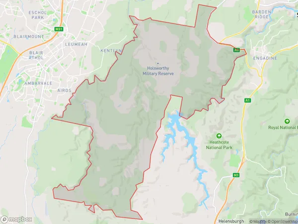
Holsworthy Military Area Suburbs & Region, Holsworthy Military Area Map & Postcodes
Holsworthy Military Area Suburbs & Region, Holsworthy Military Area Map & Postcodes in Holsworthy Military Area, Campbelltown (NSW), Sydney Outer South West, NSW, AU
Holsworthy Military Area Region
Region Name
Holsworthy Military Area (NSW, AU)Holsworthy Military Area Area
129.82 square kilometers (129.82 ㎢)Holsworthy Military Area Introduction
Holsworthy Military Area is a military installation located in Sydney's outer south-west, New South Wales, Australia. It is home to the Australian Army's 1st Armoured Regiment and is responsible for providing land warfare training to the Australian Defence Force. The base is named after the town of Holsworthy, which is located nearby. The area is also home to a number of historical sites, including the Holsworthy Barracks, which was built in the 1870s and is now a heritage-listed site.Australia State
City or Big Region
Greater Capital City
Greater Sydney (1GSYD)District or Regional Area
Suburb Name
Holsworthy Military Area Suburbs
Holsworthy Military Area full address
Holsworthy Military Area, Campbelltown (NSW), Sydney Outer South West, New South Wales, NSW, Australia, SaCode: 123021439Country
Holsworthy Military Area, Campbelltown (NSW), Sydney Outer South West, New South Wales, NSW, Australia, SaCode: 123021439
Holsworthy Military Area Suburbs & Region, Holsworthy Military Area Map & Postcodes has 0 areas or regions above, and there are 0 Holsworthy Military Area suburbs below. The sa2code for the Holsworthy Military Area region is 123021439. Holsworthy Military Area area belongs to Australia's greater capital city Greater Sydney.
