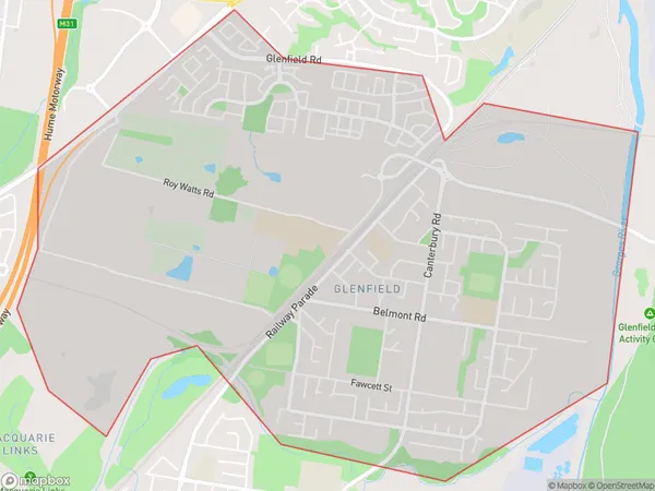
Glenfield Suburbs & Region, Glenfield Map & Postcodes
Glenfield Suburbs & Region, Glenfield Map & Postcodes in Glenfield, Campbelltown (NSW), Sydney Outer South West, NSW, AU
Glenfield Region
Region Name
Glenfield (NSW, AU)Glenfield Area
6.99 square kilometers (6.99 ㎢)Glenfield Introduction
Glenfield is a suburb in the southern suburbs of Sydney, in the state of New South Wales, Australia. It is located 21 kilometers south-west of the Sydney central business district and is part of the Macarthur region. The suburb is named after the Glenfield railway station, which was opened on 1 October 1889. Glenfield is a diverse suburb with a mix of residential, commercial, and industrial areas. The population of Glenfield is approximately 30,000 people, with a majority of residents being of Asian descent. The suburb has a number of shopping centers, including the Glenfield Plaza and the Glenfield Town Center, as well as a large mosque and a Hindu temple. Glenfield is well-connected to other parts of Sydney, with the M4 motorway and the South West Rail Line providing easy access to the city. The suburb also has a number of parks and recreational facilities, including the Glenfield Park Sports Complex and the Glenfield Aquatic Center.Australia State
City or Big Region
Greater Capital City
Greater Sydney (1GSYD)District or Regional Area
Suburb Name
Glenfield Suburbs
Glenfield full address
Glenfield, Campbelltown (NSW), Sydney Outer South West, New South Wales, NSW, Australia, SaCode: 123021704Country
Glenfield, Campbelltown (NSW), Sydney Outer South West, New South Wales, NSW, Australia, SaCode: 123021704
Glenfield Suburbs & Region, Glenfield Map & Postcodes has 0 areas or regions above, and there are 0 Glenfield suburbs below. The sa2code for the Glenfield region is 123021704. Glenfield area belongs to Australia's greater capital city Greater Sydney.
