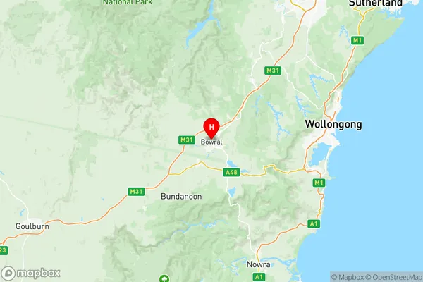
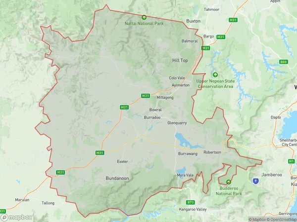
Southern Highlands Suburbs & Region, Southern Highlands Map & Postcodes
Southern Highlands Suburbs & Region, Southern Highlands Map & Postcodes in Southern Highlands, Southern Highlands and Shoalhaven, NSW, AU
Southern Highlands Region
Region Name
Southern Highlands (NSW, AU)Southern Highlands Area
2330 square kilometers (2,330 ㎢)Postal Codes
2527, 2533, and from 2575 to 2579 (In total, there are 7 postcodes in Southern Highlands.)Southern Highlands Introduction
The Southern Highlands is a region in Southern New South Wales, Australia. It is located in the Illawarra region and is known for its scenic beauty, including the Blue Mountains, the Southern Highlands Botanic Garden, and the Bowral Golf Club. The region is home to a diverse range of wildlife, including kangaroos, wallabies, and echidnas. It is also a popular destination for outdoor activities such as hiking, cycling, and picnicking. The Southern Highlands is located approximately 60 kilometers south of Sydney and is easily accessible by road. It is a popular weekend getaway for Sydney residents and tourists alike.Australia State
City or Big Region
District or Regional Area
Southern Highlands Region Map

Southern Highlands Postcodes / Zip Codes
Southern Highlands Suburbs
Illawarra Catchment Reserve
Albion Park Macquarie Pass
Southern Highlands
Southern Highlands full address
Southern Highlands, Southern Highlands and Shoalhaven, New South Wales, NSW, Australia, SaCode: 11402Country
Southern Highlands, Southern Highlands and Shoalhaven, New South Wales, NSW, Australia, SaCode: 11402
Southern Highlands Suburbs & Region, Southern Highlands Map & Postcodes has 11 areas or regions above, and there are 86 Southern Highlands suburbs below. The sa3code for the Southern Highlands region is 11402. Its latitude and longitude coordinates are -34.4788,150.418.
Southern Highlands Suburbs & Localities
1. Albion Park
2. Albion Park Rail
3. Calderwood
4. Croom
5. North Macquarie
6. Tongarra
7. Tullimbar
8. Yellow Rock
9. Bombo
10. Curramore
11. Jamberoo
12. Jerrara
13. Kiama
14. Kiama Downs
15. Kiama Heights
16. Minnamurra
17. Saddleback Mountain
18. Alpine
19. Aylmerton
20. Balaclava
21. Barrallier
22. Braemar
23. Bullio
24. Colo Vale
25. Goodmans Ford
26. High Range
27. Hill Top
28. Joadja
29. Mandemar
30. Mittagong
31. Mount Lindsey
32. Renwick
33. Wattle Ridge
34. Welby
35. Willow Vale
36. Woodlands
37. Yerrinbool
38. Bong Bong
39. Bowral
40. Burradoo
41. East Bowral
42. East Kangaloon
43. Glenquarry
44. Kangaloon
45. Avoca
46. Barren Grounds
47. Barrengarry
48. Beaumont
49. Belanglo
50. Bendeela
51. Berrima
52. Budgong
53. Burrawang
54. Calwalla
55. Canyonleigh
56. Carrington Falls
57. Fitzroy Falls
58. Kangaroo Valley
59. Knights Hill
60. Macquarie Pass
61. Manchester Square
62. Medway
63. Meryla
64. Moss Vale
65. Mount Murray
66. Myra Vale
67. New Berrima
68. Paddys River
69. Pheasant Ground
70. Red Rocks
71. Robertson
72. Sutton Forest
73. Upper Kangaroo River
74. Upper Kangaroo Valley
75. Werai
76. Wildes Meadow
77. Yarrunga
78. Bundanoon
79. Big Hill
80. Brayton
81. Exeter
82. Marulan
83. Marulan South
84. Penrose
85. Tallong
86. Wingello
