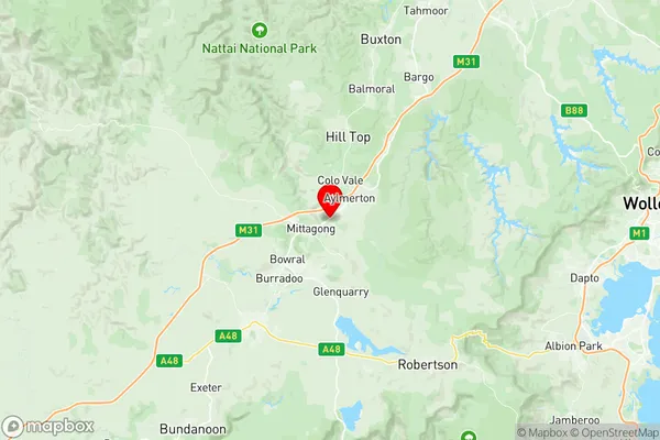
Mittagong Suburbs & Region, Mittagong Map & Postcodes
Mittagong Suburbs & Region, Mittagong Map & Postcodes in Mittagong, Southern Highlands, Southern Highlands and Shoalhaven, NSW, AU
Mittagong Region
Region Name
Mittagong (NSW, AU)Mittagong Area
73.76 square kilometers (73.76 ㎢)Postal Codes
2575 (In total, there are 1 postcodes in Mittagong.)Mittagong Introduction
Mittagong is a town in the Southern Highlands and Shoalhaven regions of New South Wales, Australia. It is situated on the banks of the Mittagong River and is approximately 125 kilometers south of Sydney. The town is known for its scenic beauty, with the Blue Mountains to the west and the Illawarra Range to the east. Mittagong is a popular destination for tourists and has a variety of attractions, including the Mittagong Railway Museum, the National Trust's Bowral Wool Museum, and the Mount Gibraltar Reserve. The town also has a number of cafes, restaurants, and shops.Australia State
City or Big Region
Greater Capital City
Rest of NSW (1RNSW)District or Regional Area
Suburb Name
Mittagong Region Map

Mittagong Postcodes / Zip Codes
Mittagong Suburbs
Mittagong full address
Mittagong, Southern Highlands, Southern Highlands and Shoalhaven, New South Wales, NSW, Australia, SaCode: 114021286Country
Mittagong, Southern Highlands, Southern Highlands and Shoalhaven, New South Wales, NSW, Australia, SaCode: 114021286
Mittagong Suburbs & Region, Mittagong Map & Postcodes has 0 areas or regions above, and there are 7 Mittagong suburbs below. The sa2code for the Mittagong region is 114021286. Its latitude and longitude coordinates are -34.4413,150.471. Mittagong area belongs to Australia's greater capital city Rest of NSW.
Mittagong Suburbs & Localities
1. Aylmerton
2. Balaclava
3. Mittagong
4. Renwick
5. Welby
6. Willow Vale
7. Braemar
