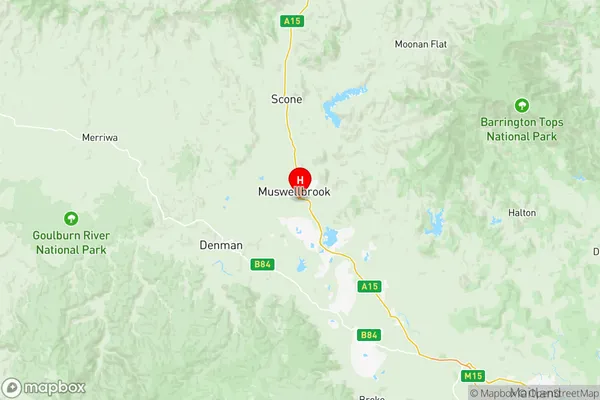
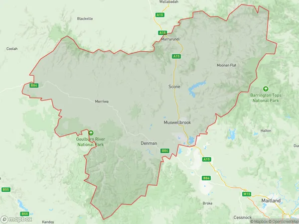
Upper Hunter Suburbs & Region, Upper Hunter Map & Postcodes
Upper Hunter Suburbs & Region, Upper Hunter Map & Postcodes in Upper Hunter, Hunter Valley exc Newcastle, NSW, AU
Upper Hunter Region
Region Name
Upper Hunter (NSW, AU)Upper Hunter Area
11472 square kilometers (11,472 ㎢)Postal Codes
2328, 2329, 2333, 2336, and 2850 (In total, there are 5 postcodes in Upper Hunter.)Upper Hunter Introduction
Upper Hunter, Hunter Valley exc Newcastle, New South Wales, AU, is a region located in the Hunter Region of New South Wales, Australia. It is known for its scenic landscapes, including rolling hills, vineyards, and forests. The region is home to several wineries and is a popular tourist destination for wine lovers. The Upper Hunter River flows through the region, providing water for agriculture and hydroelectric power generation. The region is also home to a number of historic towns, including Maitland, Muswellbrook, and Scone.Australia State
City or Big Region
District or Regional Area
Upper Hunter Region Map

Upper Hunter Postcodes / Zip Codes
Upper Hunter Suburbs
Upper Hunter full address
Upper Hunter, Hunter Valley exc Newcastle, New South Wales, NSW, Australia, SaCode: 10604Country
Upper Hunter, Hunter Valley exc Newcastle, New South Wales, NSW, Australia, SaCode: 10604
Upper Hunter Suburbs & Region, Upper Hunter Map & Postcodes has 5 areas or regions above, and there are 115 Upper Hunter suburbs below. The sa3code for the Upper Hunter region is 10604. Its latitude and longitude coordinates are -32.2848,150.905.
Upper Hunter Suburbs & Localities
1. Dalswinton
2. Giants Creek
3. Hollydeen
4. Mangoola
5. Martindale
6. Widden
7. Cassilis
8. Gungal
9. Muswellbrook
10. Rouchel Brook
11. Upper Rouchel
12. Castle Rock
13. Liddell
14. Sandy Hollow
15. Wybong
16. Aberdeen
17. Kerrabee
18. Borambil
19. Baerami
20. Bengalla
21. Edderton
22. Kayuga
23. Manobalai
24. Muscle Creek
25. Davis Creek
26. Rouchel
27. Upper Dartbrook
28. Bureen
29. Denman
30. Yarrawa
31. Merriwa
32. Uarbry
33. Baerami Creek
34. Mccullys Gap
35. Dartbrook
36. Rossgole
37. Aarons Pass
38. Canadian Lead
39. Cooks Gap
40. Cullenbone
41. Cumbo
42. Eurunderee
43. Galambine
44. Ilford
45. Milroy
46. Mullamuddy
47. Riverlea
48. Running Stream
49. Twelve Mile
50. Ullamalla
51. Botobolar
52. Buckaroo
53. Budgee Budgee
54. Caerleon
55. Cross Roads
56. Frog Rock
57. Glen Ayr
58. Green Gully
59. Gulgamree
60. Monivae
61. Munghorn
62. Queens Pinch
63. Sallys Flat
64. St Fillans
65. Tambaroora
66. Triamble
67. Turill
68. Wilpinjong
69. Wollar
70. Worlds End
71. Bara
72. Ben Buckley
73. Bocoble
74. Erudgere
75. Havilah
76. Hayes Gap
77. Hill End
78. Long Creek
79. Lue
80. Maitland Bar
81. Menah
82. Mount Frome
83. Mount Knowles
84. Mudgee
85. Murragamba
86. Piambong
87. Pyramul
88. Stony Creek
89. Totnes Valley
90. Wilbetree
91. Windeyer
92. Apple Tree Flat
93. Avisford
94. Barigan
95. Bombira
96. Burrundulla
97. Carcalgong
98. Collingwood
99. Cooyal
100. Cudgegong
101. Grattai
102. Hargraves
103. Home Rule
104. Kains Flat
105. Linburn
106. Meroo
107. Millsville
108. Mogo
109. Moolarben
110. Putta Bucca
111. Spring Flat
112. Tichular
113. Ulan
114. Yarrabin
115. Yarrawonga
