Maitland Suburbs & Region, Maitland Map & Postcodes
Maitland Suburbs & Region, Maitland Map & Postcodes in Maitland, Hunter Valley exc Newcastle, NSW, AU
Maitland Region
Region Name
Maitland (NSW, AU)Maitland Area
380.12 square kilometers (380.12 ㎢)Postal Codes
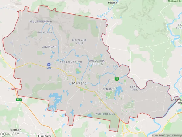
2326, 2335, and 2421 (In total, there are 3 postcodes in Maitland.)Maitland Suburb Area Map (Polygon)
Maitland Introduction
Maitland is a city in the Hunter Region of New South Wales, Australia, and is the administrative center of the City of Maitland. It is located about 110 kilometers (68 mi) north of Sydney and 15 kilometers (9 mi) south of Newcastle. Maitland is known for its historic buildings, including the Maitland Gaol, which is now a museum. The city also has a number of parks and gardens, including the Maitland Botanic Garden, which is one of the largest botanical gardens in Australia.Australia State
City or Big Region
District or Regional Area
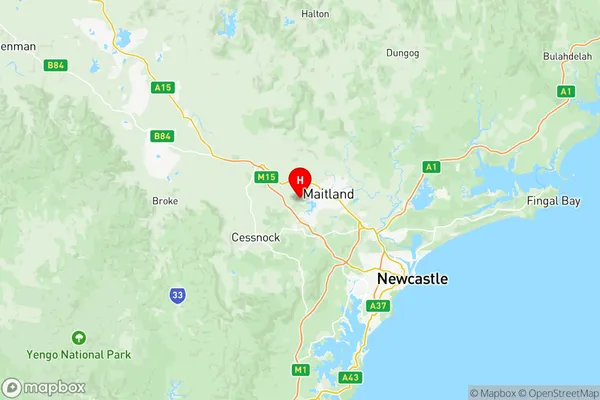
Maitland Region Map
Maitland Postcodes / Zip Codes
Maitland Suburbs
Branxton Greta Pokolbin
East Maitland Metford
Rutherford (North) Aberglasslyn
Rutherford (South) Telarah
Tenambit East Maitland
Thornton Millers Forest
Inverell Region West
Maitland full address
Maitland, Hunter Valley exc Newcastle, New South Wales, NSW, Australia, SaCode: 10602Country
Maitland, Hunter Valley exc Newcastle, New South Wales, NSW, Australia, SaCode: 10602
Maitland Suburbs & Region, Maitland Map & Postcodes has 9 areas or regions above, and there are 24 Maitland suburbs below. The sa3code for the Maitland region is 10602. Its latitude and longitude coordinates are -32.7455,151.473.
Maitland Suburbs & Localities
1. Bishops Bridge
2. Sawyers Gully
3. Dalwood
4. Lambs Valley
5. Leconfield
6. Branxton
7. North Rothbury
8. Weston
9. Elderslie
10. Lower Belford
11. Stanhope
12. Abermain
13. Loxford
14. Neath
15. Belford
16. East Branxton
17. Fishers Hill
18. Paterson
19. Tocal
20. Vacy
21. Webbers Creek
22. Torryburn
23. Summer Hill
24. Trevallyn