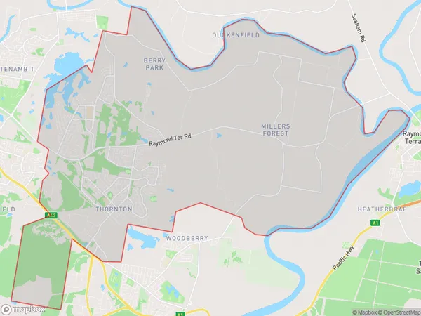
Thornton Millers Forest Suburbs & Region, Thornton Millers Forest Map & Postcodes
Thornton Millers Forest Suburbs & Region, Thornton Millers Forest Map & Postcodes in Thornton Millers Forest, Maitland, Hunter Valley exc Newcastle, NSW, AU
Thornton Millers Forest Region
Region Name
Thornton Millers Forest (NSW, AU)Thornton Millers Forest Area
63.1 square kilometers (63.1 ㎢)Thornton Millers Forest Introduction
Thornton Millers Forest is a privately owned forest located in the Hunter Valley region of New South Wales, Australia. It is situated between the towns of Maitland and Newcastle and covers an area of approximately 1,200 hectares. The forest is known for its diverse range of plant and animal species, including native trees, shrubs, and wildlife such as kangaroos, wallabies, and birds. Visitors can enjoy walking trails, picnic areas, and a visitors center that provides information about the forest's history and conservation efforts. The forest is also home to a range of recreational activities, including mountain biking, horse riding, and fishing.Australia State
City or Big Region
Greater Capital City
Rest of NSW (1RNSW)District or Regional Area
Suburb Name
Thornton Millers Forest Suburbs
Thornton Millers Forest full address
Thornton Millers Forest, Maitland, Hunter Valley exc Newcastle, New South Wales, NSW, Australia, SaCode: 106021618Country
Thornton Millers Forest, Maitland, Hunter Valley exc Newcastle, New South Wales, NSW, Australia, SaCode: 106021618
Thornton Millers Forest Suburbs & Region, Thornton Millers Forest Map & Postcodes has 0 areas or regions above, and there are 0 Thornton Millers Forest suburbs below. The sa2code for the Thornton Millers Forest region is 106021618. Thornton Millers Forest area belongs to Australia's greater capital city Rest of NSW.
