Methven Suburbs & Region, Methven Map & Postcodes in Methven, Ashburton, Canterbury
Methven Postcodes, Methven ZipCodes, Methven , Methven Canterbury, Methven Suburbs, Methven Region, Methven Map, Methven Area
Methven Region
Methven Suburbs
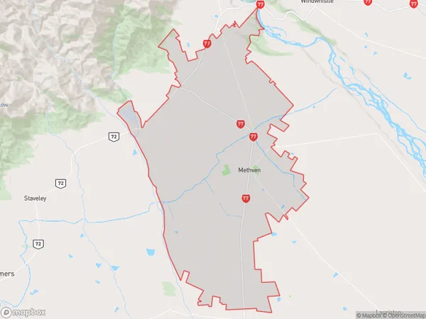
Methven is a suburb place type in Ashburton, Canterbury, NZ. It contains 5 suburbs or localities.Methven Region Map
Methven Introduction
Methven is a small town in Canterbury, New Zealand, located in the Ashburton District. It is known for its scenic surroundings, including the Mount Hutt Range and the Rakaia River. The town has a population of around 3,000 people and is a popular destination for outdoor enthusiasts, with many hiking and skiing trails nearby. Methven also has a historic railway station, which is part of the Southern Alps Scenic Railway.Methven Region
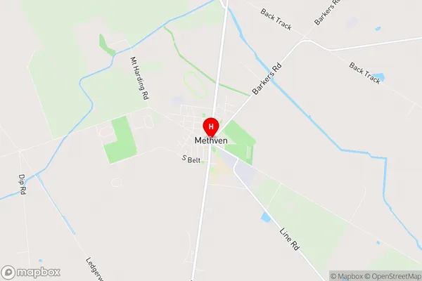
Methven City
Methven Satellite Map

Full Address
Methven, Ashburton, CanterburyMethven Coordinates
-43.632433,171.647261 (Latitude / Longitude)Methven Map in NZ
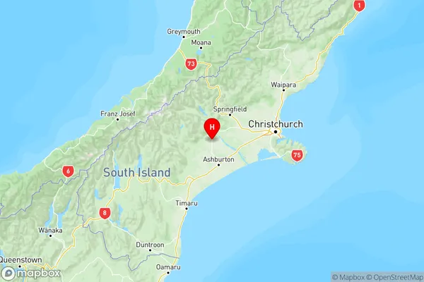
NZ Island
South IslandCountry
Methven Area Map (Polygon)
Name
MethvenAdditional Name
Local Authority
Ashburton District
Methven Suburbs (Sort by Population)
Methven
Methven - 2614Highbank
Highbank - 246Mount Hutt
Mount Hutt - 95Pudding Hill
Pudding Hill - 36Double Hill
Double Hill - 9