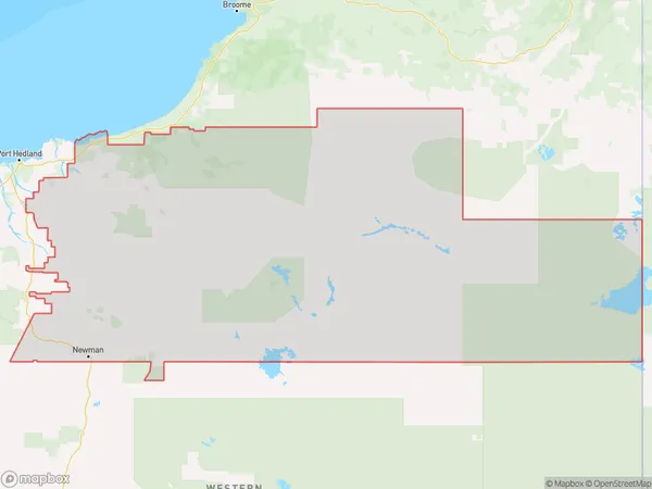
Pilbara Suburbs & Region, Pilbara Map & Postcodes
Pilbara Suburbs & Region, Pilbara Map & Postcodes in Pilbara, Western Australia Outback, WA, AU
Pilbara Region
Region Name
Pilbara (WA, AU)Postal Codes
from 6710 to 6714, 6716, 6718, from 6720 to 6722, 6751, 6753, 6754, 6758, 6760, and 6762 (In total, there are 16 postcodes in Pilbara.)Pilbara Introduction
Pilbara is a region in Western Australia known for its rich mining industry and stunning natural beauty. It is located in the north-west of the state and is home to some of the world's largest iron ore mines. The Pilbara region is also home to a variety of wildlife, including kangaroos, wallabies, and emus. The region has a warm, dry climate and is known for its stunning sunsets and starry nights. Visitors to the Pilbara can explore the region's many national parks and wildlife reserves, including Karijini National Park and the Pilbara National Park. The region is also home to a number of towns, including Port Hedland, Karratha, and Newman.Australia State
City or Big Region
District or Regional Area
Pilbara Postcodes / Zip Codes
Pilbara Suburbs
Pilbara full address
Pilbara, Western Australia Outback, Western Australia, WA, Australia, SaCode: 50806Country
Pilbara, Western Australia Outback, Western Australia, WA, Australia, SaCode: 50806
Pilbara Suburbs & Region, Pilbara Map & Postcodes has 5 areas or regions above, and there are 67 Pilbara suburbs below. The sa3code for the Pilbara region is 50806.
Pilbara Suburbs & Localities
1. Cane
2. Onslow
3. Peedamulla
4. Talandji
5. Yannarie
6. Thevenard Island
7. Barrow Island
8. Dampier
9. Dampier Archipelago
10. Antonymyre
11. Balla Balla
12. Baynton
13. Bulgarra
14. Burrup
15. Cleaverville
16. Cooya Pooya
17. Gap Ridge
18. Gnoorea
19. Karratha
20. Karratha Industrial Estate
21. Maitland
22. Mardie
23. Millars Well
24. Mount Anketell
25. Mulataga
26. Nickol
27. Pegs Creek
28. Sherlock
29. Stove Hill
30. Fortescue
31. Hamersley Range
32. Millstream
33. Pannawonica
34. Roebourne
35. Whim Creek
36. Cossack
37. Point Samson
38. Wickham
39. Indee
40. Mundabullangana
41. Pardoo
42. Port Hedland
43. Redbank
44. Strelley
45. Wallareenya
46. Wedgefield
47. Boodarie
48. De Grey
49. Finucane
50. Pippingarra
51. South Hedland
52. Chichester
53. Innawanga
54. Juna Downs
55. Karijini
56. Mount Sheila
57. Mulga Downs
58. Nanutarra
59. Rocklea
60. Tom Price
61. Wittenoom
62. Jigalong
63. Newman
64. Paraburdoo
65. Nullagine
66. Marble Bar
67. Telfer
