Perth City Suburbs & Region, Perth City Map & Postcodes
Perth City Suburbs & Region, Perth City Map & Postcodes in Perth City, Perth Inner, WA, AU
Perth City Region
Region Name
Perth City (WA, AU)Perth City Area
43.54 square kilometers (43.54 ㎢)Postal Codes
6000, 6001, from 6003 to 6008, 6800, 6803, 6809, 6817, 6820, 6827, 6830, from 6837 to 6848, 6865, 6872, 6892, from 6900 to 6904, and 6906 (In total, there are 36 postcodes in Perth City.)Perth City Introduction
Perth City is the administrative center of the Perth metropolitan area and the capital city of Western Australia. It is located on the southern bank of the Swan River, about 12 miles (19 km) east of the Indian Ocean. The city has a population of over 2 million people and is known for its beautiful beaches, vibrant arts scene, and outdoor lifestyle. It is also home to a number of major landmarks, including the Perth Concert Hall, the Art Gallery of Western Australia, and the Western Australian Museum. Perth City is a hub for business and industry, with a number of major companies and institutions based in the area. It is also a popular tourist destination, with many visitors coming to explore the city's natural beauty and cultural attractions.Australia State
City or Big Region
District or Regional Area
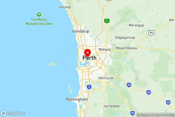
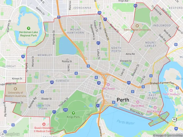
Perth City Region Map

Perth City Postcodes / Zip Codes
Perth City Suburbs
Kings Park (WA)
Perth (North) Highgate
Perth (West) Northbridge
Perth City full address
Perth City, Perth Inner, Western Australia, WA, Australia, SaCode: 50302Country
Perth City, Perth Inner, Western Australia, WA, Australia, SaCode: 50302
Perth City Suburbs & Region, Perth City Map & Postcodes has 6 areas or regions above, and there are 45 Perth City suburbs below. The sa3code for the Perth City region is 50302. Its latitude and longitude coordinates are -31.9611,115.842.
Perth City Suburbs & Localities
1. West Perth
2. Shenton Park
3. Perth
4. Highgate
5. East Perth
6. Kings Park
7. Daglish
8. Perth
9. Perth Gpo
10. Leederville
11. West Leederville
12. Subiaco East
13. City Delivery Centre
14. Northbridge
15. North Perth
16. Subiaco
17. Perth
18. Perth
19. Perth
20. Perth
21. Perth
22. Perth
23. Perth
24. Perth
25. Perth
26. West Perth
27. Leederville
28. Subiaco Po
29. Perth
30. Perth
31. Perth
32. Perth
33. Perth
34. Leederville
35. Leederville
36. North Perth
37. Northbridge
38. Perth
39. Perth
40. Perth
41. Perth
42. Northbridge
43. East Perth
44. West Leederville
45. Subiaco
