Lowood Suburbs & Region, Lowood Map & Postcodes
Lowood Suburbs & Region, Lowood Map & Postcodes in Lowood, Toowoomba, QLD, AU
Lowood Region
Region Name
Lowood (QLD, AU)Lowood Area
617.7 square kilometers (617.7 ㎢)Postal Codes
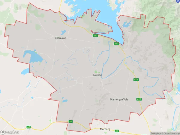
3701, 4306, and 4311 (In total, there are 3 postcodes in Lowood.)Lowood Suburb Area Map (Polygon)
Lowood Introduction
Lowood is a suburb in the City of Toowoomba, Queensland, Australia. It is located 10 kilometers west of Toowoomba's central business district. Lowood was named after a school established in 1860 by the Sisters of Mercy. The school was relocated to Toowoomba in 1876 and operated until 1998. The suburb has a population of around 3,000 people and features a variety of housing styles, including single-family homes, units, and apartments. It is home to several parks and recreational facilities, including a cricket club, tennis courts, and a swimming pool. Lowood also has a shopping center and a medical center.Australia State
City or Big Region
Greater Capital City
Greater Brisbane (3GBRI)District or Regional Area
Suburb Name
Lowood Region Map

Lowood Postcodes / Zip Codes
Lowood Suburbs
Lowood full address
Lowood, Toowoomba, Queensland, QLD, Australia, SaCode: 310021281Country
Lowood, Toowoomba, Queensland, QLD, Australia, SaCode: 310021281
Lowood Suburbs & Region, Lowood Map & Postcodes has 0 areas or regions above, and there are 30 Lowood suburbs below. The sa2code for the Lowood region is 310021281. Its latitude and longitude coordinates are -27.3919,152.5. Lowood area belongs to Australia's greater capital city Greater Brisbane.
Lowood Suburbs & Localities
1. Fernvale
2. Fernvale
3. Vernor
4. Bellhaven
5. Fairney View
6. Glamorgan Vale
7. Wivenhoe Pocket
8. Coominya
9. Lake Wivenhoe
10. Mount Tarampa
11. Patrick Estate
12. Clarendon
13. Lowood
14. Minden
15. Banks Creek
16. Borallon
17. Forest Glade
18. Split Yard Creek
19. Atkinsons Dam
20. Brightview
21. Prenzlau
22. Rifle Range
23. England Creek
24. Harlin
25. Lark Hill
26. Wanora
27. Wivenhoe
28. Coolana
29. Tarampa
30. Wivenhoe Hill