Gold Coast Hinterland Suburbs & Region, Gold Coast Hinterland Map & Postcodes
Gold Coast Hinterland Suburbs & Region, Gold Coast Hinterland Map & Postcodes in Gold Coast Hinterland, Gold Coast, QLD, AU
Gold Coast Hinterland Region
Region Name
Gold Coast Hinterland (QLD, AU)Gold Coast Hinterland Area
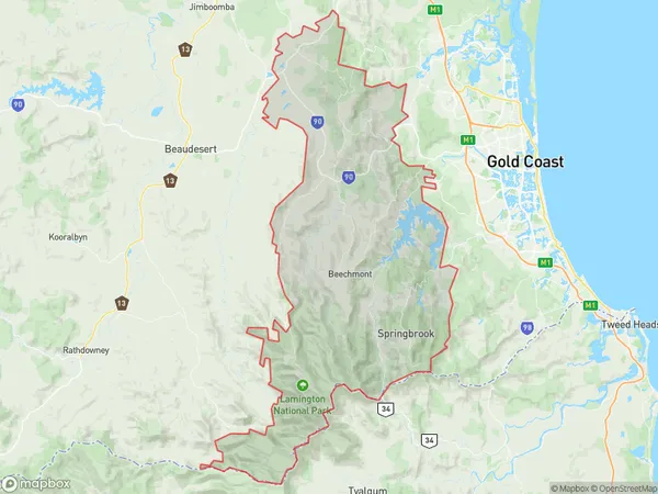
828.05 square kilometers (828.05 ㎢)Postal Codes
2484, and 4272 (In total, there are 2 postcodes in Gold Coast Hinterland.)Gold Coast Hinterland Introduction
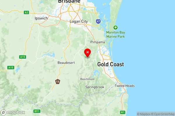
The Gold Coast Hinterland is a hilly region located in the eastern suburbs of the Gold Coast, Queensland, Australia. It is known for its lush rainforests, waterfalls, and scenic mountain views. The area is home to a variety of wildlife, including koalas, wallabies, and kangaroos. The Hinterland is also home to several popular tourist attractions, including the Mount Tamborine National Park, the Springbrook National Park, and the Kondalilla National Park. The region is a popular destination for hiking, mountain biking, and picnicking, and it is also home to a number of wineries and breweries.Australia State
City or Big Region
District or Regional Area
Gold Coast Hinterland Region Map

Gold Coast Hinterland Postcodes / Zip Codes
Gold Coast Hinterland Suburbs
Gold Coast Hinterland full address
Gold Coast Hinterland, Gold Coast, Queensland, QLD, Australia, SaCode: 30904Country
Gold Coast Hinterland, Gold Coast, Queensland, QLD, Australia, SaCode: 30904
Gold Coast Hinterland Suburbs & Region, Gold Coast Hinterland Map & Postcodes has 3 areas or regions above, and there are 61 Gold Coast Hinterland suburbs below. The sa3code for the Gold Coast Hinterland region is 30904. Its latitude and longitude coordinates are -27.9496,153.197.
Gold Coast Hinterland Suburbs & Localities
1. Boat Harbour
2. Bray Park
3. Brays Creek
4. Condong
5. Dungay
6. Kynnumboon
7. Limpinwood
8. Palmvale
9. Rowlands Creek
10. South Murwillumbah
11. Tyalgum
12. Upper Crystal Creek
13. Wardrop Valley
14. Chillingham
15. Commissioners Creek
16. Fernvale
17. Kunghur
18. Mebbin
19. Murwillumbah Dc
20. Murwillumbah South
21. Nobbys Creek
22. North Arm
23. Numinbah
24. Round Mountain
25. Tomewin
26. Back Creek
27. Byangum
28. Cedar Creek
29. Dulguigan
30. Eungella
31. Kielvale
32. Kunghur Creek
33. Mount Burrell
34. Murwillumbah
35. Nunderi
36. Reserve Creek
37. Uki
38. Zara
39. Byrrill Creek
40. Chowan Creek
41. Clothiers Creek
42. Crystal Creek
43. Cudgera Creek
44. Doon Doon
45. Dum Dum
46. Dunbible
47. Eviron
48. Farrants Hill
49. Hopkins Creek
50. Midginbil
51. Mount Warning
52. Pumpenbil
53. Smiths Creek
54. Stokers Siding
55. Terragon
56. Tyalgum Creek
57. Tygalgah
58. Urliup
59. Mount Tamborine
60. North Tamborine
61. Tamborine Mountain
