Babinda Suburbs & Region, Babinda Map & Postcodes
Babinda Suburbs & Region, Babinda Map & Postcodes in Babinda, Outback North, Queensland Outback, QLD, AU
Babinda Region
Region Name
Babinda (QLD, AU)Babinda Area
669.18 square kilometers (669.18 ㎢)Postal Codes
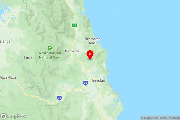
4860, 4861, and 4871 (In total, there are 3 postcodes in Babinda.)Babinda Suburb Area Map (Polygon)

Babinda Introduction
Babinda is a locality in the Shire of Babinda, Queensland, Australia. It is one of the few places in Australia where coal is still mined commercially. The town is located 135 kilometres (84 mi) north of Cairns. Babinda Bore is a large artesian bore that supplies water to the town. The town has a population of around 1,200 people. The nearby Mount Superbus National Park is a popular destination for tourists. The town is named after the Babinda River, which flows through the locality.Australia State
City or Big Region
Greater Capital City
Rest of Qld (3RQLD)District or Regional Area
Suburb Name
Babinda Region Map
Babinda Postcodes / Zip Codes
Babinda Suburbs
Babinda full address
Babinda, Outback North, Queensland Outback, Queensland, QLD, Australia, SaCode: 306031158Country
Babinda, Outback North, Queensland Outback, Queensland, QLD, Australia, SaCode: 306031158
Babinda Suburbs & Region, Babinda Map & Postcodes has 0 areas or regions above, and there are 23 Babinda suburbs below. The sa2code for the Babinda region is 306031158. Its latitude and longitude coordinates are -17.4346,145.992. Babinda area belongs to Australia's greater capital city Rest of Qld.
Babinda Suburbs & Localities
1. Eubenangee
2. Bramston Beach
3. Deeral
4. Woopen Creek
5. Jubilee Heights
6. Upper Daradgee
7. Wanjuru
8. Bartle Frere
9. East Russell
10. Bellenden Ker
11. Mirriwinni
12. Waugh Pocket
13. Daradgee
14. Flying Fish Point
15. Vasa Views
16. Cooroo Lands
17. Fitzgerald Creek
18. Garradunga
19. Miriwinni
20. Ngatjan
21. Babinda
22. Aloomba
23. Fishery Falls