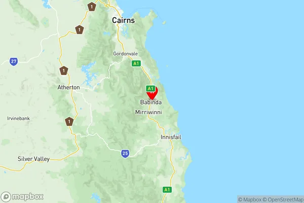
Innisfail Cassowary Coast Suburbs & Region, Innisfail Cassowary Coast Map & Postcodes
Innisfail Cassowary Coast Suburbs & Region, Innisfail Cassowary Coast Map & Postcodes in Innisfail Cassowary Coast, Cairns, QLD, AU
Innisfail Cassowary Coast Region
Region Name
Innisfail Cassowary Coast (QLD, AU)Innisfail Cassowary Coast Area
5995 square kilometers (5,995 ㎢)Postal Codes
4849, 4852, from 4854 to 4859, and 4861 (In total, there are 9 postcodes in Innisfail Cassowary Coast.)Innisfail Cassowary Coast Introduction
Innisfail is a town and locality in the Cassowary Coast Region, Queensland, Australia. It is one of the major gateways to the tropical north of Queensland. The town is located 135 km north of Cairns and 365 km north of Brisbane. It is situated on the southern bank of the Johnstone River. The town was named after Innisfail, Scotland. The population of Innisfail was 5,140 at the 2011 census. The town has a tropical climate with high humidity and rainfall. It is known for its agriculture, particularly sugarcane and banana farming. The town also has a number of tourist attractions, including the Innisfail Botanic Gardens, the Johnstone River National Park, and the Great Barrier Reef.Australia State
City or Big Region
District or Regional Area
Innisfail Cassowary Coast Region Map

Innisfail Cassowary Coast Postcodes / Zip Codes
Innisfail Cassowary Coast Suburbs
Innisfail Cassowary Coast full address
Innisfail Cassowary Coast, Cairns, Queensland, QLD, Australia, SaCode: 30603Country
Innisfail Cassowary Coast, Cairns, Queensland, QLD, Australia, SaCode: 30603
Innisfail Cassowary Coast Suburbs & Region, Innisfail Cassowary Coast Map & Postcodes has 1 areas or regions above, and there are 72 Innisfail Cassowary Coast suburbs below. The sa3code for the Innisfail Cassowary Coast region is 30603. Its latitude and longitude coordinates are -17.3407,145.928.
Innisfail Cassowary Coast Suburbs & Localities
1. Rungoo
2. Bingil Bay
3. Midgeree Bar
4. South Mission
5. South Mission Beach
6. Dingo Pocket
7. El Arish
8. Friday Pocket
9. Jaffa
10. Maadi
11. Maria Creeks
12. Shell Pocket
13. Goolboo
14. Cardwell
15. Hinchinbrook
16. Carmoo
17. Mission Beach
18. East Feluga
19. Euramo
20. Feluga
21. Hull Heads
22. Jarra Creek
23. Merryburn
24. Midgenoo
25. Murray Upper
26. Rockingham
27. Tully Heads
28. Gulngai
29. Silkwood East
30. Japoonvale
31. No 5 Branch
32. Bartle Frere
33. East Russell
34. Lumholtz
35. Clump Point
36. Dunk
37. Tam Oshanter
38. Bilyana
39. Birkalla
40. Bulgun
41. Kooroomool
42. Lower Tully
43. Mount Mackay
44. Munro Plains
45. Tully
46. Daveson
47. Granadilla
48. Mccutcheon
49. Etty Bay
50. Mourilyan
51. New Harbourline
52. Damper Creek
53. Djiru
54. Garners Beach
55. Narragon Beach
56. Wongaling Beach
57. Cardstone
58. Djarawong
59. Jarra Creek
60. Murrigal
61. Silky Oak
62. Walter Hill
63. Warrami
64. No 4 Branch
65. Silkwood
66. Walter Lever Estate
67. Comoon Loop
68. Martyville
69. Mourilyan Harbour
70. No 6 Branch
71. South Johnstone
72. Babinda
