Grange Suburbs & Region, Grange Map & Postcodes
Grange Suburbs & Region, Grange Map & Postcodes in Grange, Brisbane Inner West, Brisbane Inner City, QLD, AU
Grange Region
Region Name
Grange (QLD, AU)Grange Area
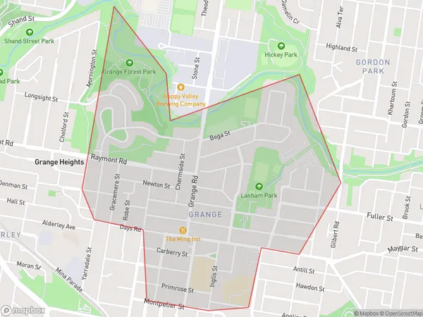
1.79 square kilometers (1.79 ㎢)Postal Codes
4051 (In total, there are 1 postcodes in Grange.)Grange Suburb Area Map (Polygon)
Grange Introduction
Grange is a suburb in the inner city of Brisbane, Queensland, Australia. It is located 4 kilometers south of the Brisbane CBD and is bordered by the suburbs of Toowong, Auchenflower, and Milton. Grange has a rich history and was once known as a farming community. It is home to several heritage-listed buildings, including the Grange Hotel and the Old Government House. The suburb is also known for its vibrant arts scene, with several galleries and museums located in the area. Today, Grange is a popular residential area with a mix of apartments, houses, and townhouses. It is surrounded by parks and recreational facilities, including the Brisbane Riverwalk and the South Bank Parklands.Australia State
City or Big Region
Greater Capital City
Greater Brisbane (3GBRI)District or Regional Area
Suburb Name
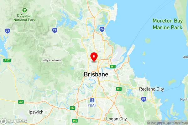
Grange Region Map
Grange Postcodes / Zip Codes
Grange Suburbs
Grange full address
Grange, Brisbane Inner West, Brisbane Inner City, Queensland, QLD, Australia, SaCode: 305031123Country
Grange, Brisbane Inner West, Brisbane Inner City, Queensland, QLD, Australia, SaCode: 305031123
Grange Suburbs & Region, Grange Map & Postcodes has 0 areas or regions above, and there are 2 Grange suburbs below. The sa2code for the Grange region is 305031123. Its latitude and longitude coordinates are -27.423,153.015. Grange area belongs to Australia's greater capital city Greater Brisbane.
Grange Suburbs & Localities
1. The Grange
2. Grange