The Grange Area, The Grange Postcode(4051) & Map in The Grange, Brisbane Inner City, QLD
The Grange Area, The Grange Postcode(4051) & Map in The Grange, Brisbane Inner City, QLD, AU, Postcode: 4051
The Grange, Grange, Brisbane Inner - North, Brisbane Inner City, Queensland, Australia, 4051
The Grange Postcode
Area Name
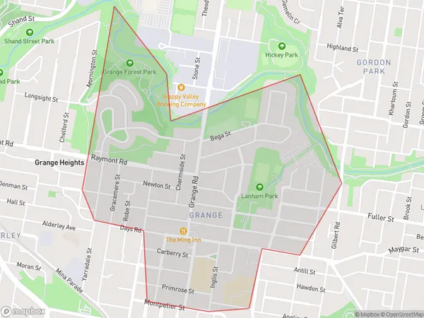
The GrangeThe Grange Suburb Area Map (Polygon)
The Grange Introduction
The Grange is a heritage-listed residence located in the Brisbane Inner City, Queensland, Australia. It is a substantial and impressive building that was designed by John H. Buckeridge and constructed in 1886-1887. It is renowned for its Gothic Revival architecture and its intricate decorative features, which include stained glass windows, carved woodwork, and tiled floors. The Grange is a significant example of the residential architecture of the late 19th century and is considered one of the most important buildings in Brisbane's history.State Name
City or Big Region
District or Regional Area
Suburb Name
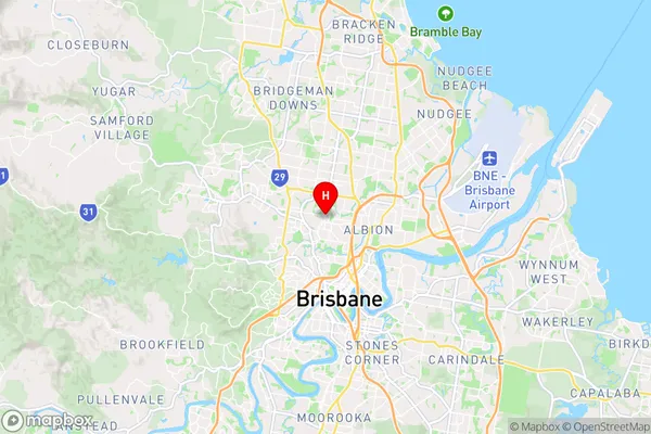
The Grange Region Map

Country
Main Region in AU
R1Coordinates
-27.423,153.015 (latitude/longitude)The Grange Area Map (Street)
Longitude
153.000297Latitude
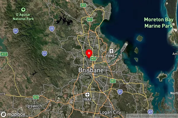
-27.427508The Grange Suburb Map (Satellite)
Distances
The distance from The Grange, Brisbane Inner City, QLD to AU Greater Capital CitiesSA1 Code 2011
30503112308SA1 Code 2016
30503112308SA2 Code
305031123SA3 Code
30503SA4 Code
305RA 2011
1RA 2016
1MMM 2015
1MMM 2019
1Charge Zone
Q1LGA Region
BrisbaneLGA Code
31000Electorate
Ryan