Yarra Valley Suburbs & Region, Yarra Valley Map & Postcodes
Yarra Valley Suburbs & Region, Yarra Valley Map & Postcodes in Yarra Valley, Yarra Ranges, Melbourne Outer East, VIC, AU
Yarra Valley Region
Region Name
Yarra Valley (VIC, AU)Yarra Valley Area
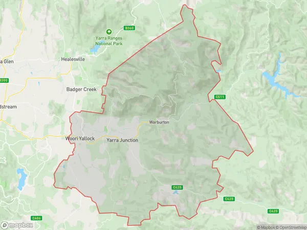
729.76 square kilometers (729.76 ㎢)Postal Codes
3139, 3797, and 3799 (In total, there are 3 postcodes in Yarra Valley.)Yarra Valley Suburb Area Map (Polygon)
Australia State
City or Big Region
Greater Capital City
Greater Melbourne (2GMEL)District or Regional Area
Suburb Name
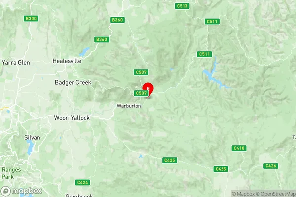
Yarra Valley Region Map
Yarra Valley Postcodes / Zip Codes
Yarra Valley Suburbs
Yarra Valley full address
Yarra Valley, Yarra Ranges, Melbourne Outer East, Victoria, VIC, Australia, SaCode: 211051286Country
Yarra Valley, Yarra Ranges, Melbourne Outer East, Victoria, VIC, Australia, SaCode: 211051286
Yarra Valley Suburbs & Region, Yarra Valley Map & Postcodes has 0 areas or regions above, and there are 16 Yarra Valley suburbs below. The sa2code for the Yarra Valley region is 211051286. Its latitude and longitude coordinates are -37.737,145.742. Yarra Valley area belongs to Australia's greater capital city Greater Melbourne.
Yarra Valley Suburbs & Localities
1. Hoddles Creek
2. Launching Place
3. Woori Yallock
4. Beenak
5. Don Valley
6. Yellingbo
7. Gilderoy
8. Gladysdale
9. East Warburton
10. Three Bridges
11. Yarra Junction
12. Millgrove
13. Warburton
14. Wesburn
15. Powelltown
16. Big Pats Creek