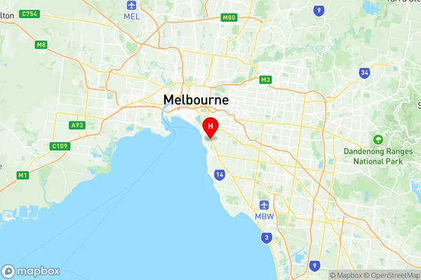
Elwood Suburbs & Region, Elwood Map & Postcodes
Elwood Suburbs & Region, Elwood Map & Postcodes in Elwood, Port Phillip, Melbourne Inner, VIC, AU
Elwood Region
Region Name
Elwood (VIC, AU)Elwood Area
2.55 square kilometers (2.55 ㎢)Postal Codes
3184 (In total, there are 1 postcodes in Elwood.)Elwood Introduction
Elwood is a suburb of Melbourne, Victoria, Australia, 6 km south-east of Melbourne's central business district. Its local government area is the City of Port Phillip. At the 2016 census, Elwood had a population of 11,271. Elwood is named after the Elwood Forest, which was a popular picnic spot for Melbourne residents in the 1880s. The suburb has a rich cultural heritage and is home to many historic buildings, including the Elwood Art Gallery and the Elwood Primary School. Elwood is known for its vibrant arts scene and is home to many artists, musicians, and filmmakers. The suburb has a number of cafes, restaurants, and bars, and is popular with young professionals and families. Elwood is well-connected to the rest of Melbourne, with several bus routes and the South East Freeway passing through the suburb. The beach is also a popular destination for locals, with Elwood Beach just a short walk from the suburb's center.Australia State
City or Big Region
Greater Capital City
Greater Melbourne (2GMEL)District or Regional Area
Suburb Name
Elwood Region Map

Elwood Postcodes / Zip Codes
Elwood Suburbs
Elwood full address
Elwood, Port Phillip, Melbourne Inner, Victoria, VIC, Australia, SaCode: 206051129Country
Elwood, Port Phillip, Melbourne Inner, Victoria, VIC, Australia, SaCode: 206051129
Elwood Suburbs & Region, Elwood Map & Postcodes has 0 areas or regions above, and there are 2 Elwood suburbs below. The sa2code for the Elwood region is 206051129. Its latitude and longitude coordinates are -37.8765,144.992. Elwood area belongs to Australia's greater capital city Greater Melbourne.
Elwood Suburbs & Localities
1. Brighton Road
2. Elwood
