Darebin South Suburbs & Region, Darebin South Map & Postcodes
Darebin South Suburbs & Region, Darebin South Map & Postcodes in Darebin South, Melbourne Inner, VIC, AU
Darebin South Region
Region Name
Darebin South (VIC, AU)Darebin South Area
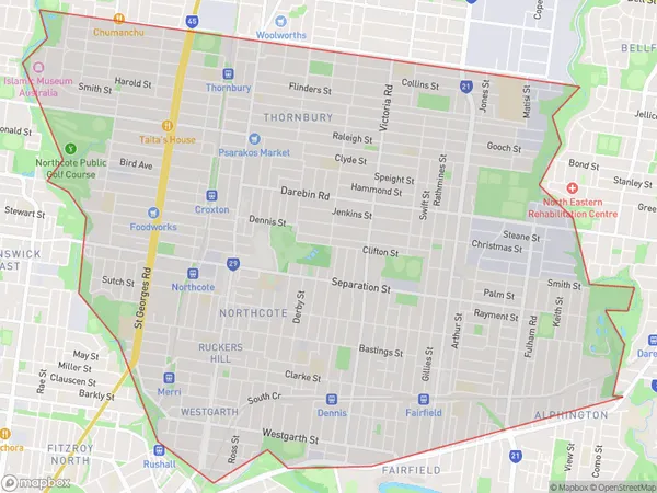
14.03 square kilometers (14.03 ㎢)Darebin South Suburb Area Map (Polygon)
Darebin South Introduction
Darebin South is a suburb in Melbourne, Victoria, Australia. It is located 7 kilometers north-east of Melbourne's central business district. The suburb is named after the Darebin Creek, which flows through it. Darebin South has a diverse population and is home to many different cultural and religious groups. The suburb has a number of parks and recreational facilities, including the Darebin Parklands, which includes the Darebin Arts and Entertainment Centre. The suburb is also home to a number of major shopping centers, including the Northland Shopping Centre and the Westfield Doncaster.Australia State
City or Big Region
District or Regional Area
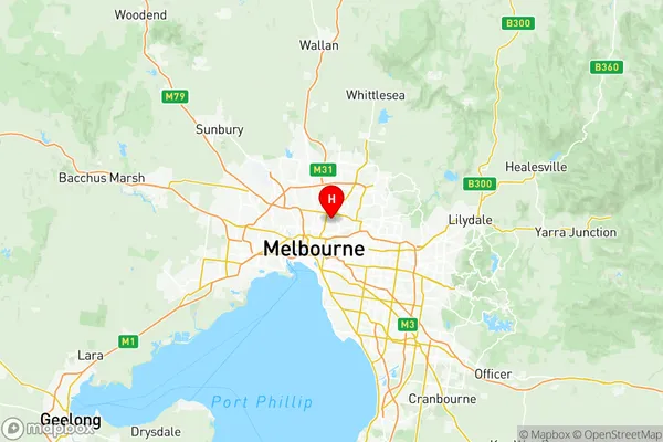
Darebin South Region Map
Darebin South Suburbs
Northcote East
Northcote West
Darebin South full address
Darebin South, Melbourne Inner, Victoria, VIC, Australia, SaCode: 20602Country
Darebin South, Melbourne Inner, Victoria, VIC, Australia, SaCode: 20602
Darebin South Suburbs & Region, Darebin South Map & Postcodes has 3 areas or regions above, and there are 0 Darebin South suburbs below. The sa3code for the Darebin South region is 20602. Its latitude and longitude coordinates are -37.76,145.008.