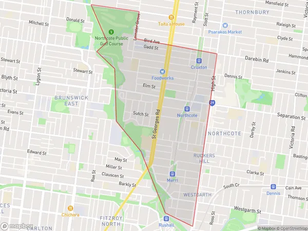
Northcote West Suburbs & Region, Northcote West Map & Postcodes
Northcote West Suburbs & Region, Northcote West Map & Postcodes in Northcote West, Darebin South, Melbourne Inner, VIC, AU
Northcote West Region
Region Name
Northcote West (VIC, AU)Northcote West Area
2.63 square kilometers (2.63 ㎢)Northcote West Introduction
Northcote West is a suburb of Melbourne, Victoria, Australia 8 km north-west of Melbourne's central business district (CBD). Its local government area is the City of Moreland. At the 2016 Census, Northcote West had a population of 11,899. Northcote West is bounded by High Street to the north, Westgarth Street to the east, Bell Street to the south, and Clarke Street to the west. Northcote Road forms its northern boundary, while the Westgarth and Clarke Streets form its eastern and southern boundaries, respectively. The suburb is home to a number of significant cultural institutions, including the Northcote Town Hall, the Northcote Library, and the Northcote Arts Centre. It is also well-known for its vibrant arts and music scene, with numerous galleries, studios, and live music venues located in the area. Northcote West is well-connected to the rest of Melbourne, with several bus routes and train stations located within the suburb. It is also within walking distance of the CBD and other popular destinations, such as the Queen Victoria Market and the Melbourne Zoo.Australia State
City or Big Region
Greater Capital City
Greater Melbourne (2GMEL)District or Regional Area
Suburb Name
Northcote West Suburbs
Northcote West full address
Northcote West, Darebin South, Melbourne Inner, Victoria, VIC, Australia, SaCode: 206021500Country
Northcote West, Darebin South, Melbourne Inner, Victoria, VIC, Australia, SaCode: 206021500
Northcote West Suburbs & Region, Northcote West Map & Postcodes has 0 areas or regions above, and there are 0 Northcote West suburbs below. The sa2code for the Northcote West region is 206021500. Northcote West area belongs to Australia's greater capital city Greater Melbourne.
