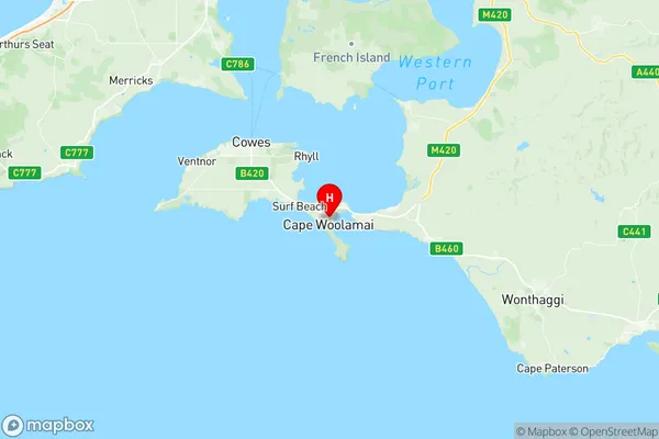
Phillip Island Suburbs & Region, Phillip Island Map & Postcodes
Phillip Island Suburbs & Region, Phillip Island Map & Postcodes in Phillip Island, Gippsland South West, Latrobe Gippsland, VIC, AU
Phillip Island Region
Region Name
Phillip Island (VIC, AU)Phillip Island Area
100.57 square kilometers (100.57 ㎢)Postal Codes
3922, 3923, and 3925 (In total, there are 3 postcodes in Phillip Island.)Phillip Island Introduction
Phillip Island is a popular holiday destination located off the coast of Victoria, Australia. It is known for its penguin colony, which is one of the largest in the world. Visitors can watch the penguins swim and feed from the boardwalk or take a guided tour to get up close to them. The island also has a variety of other wildlife, including seals, dolphins, and koalas. There are many scenic walks and beaches to explore, as well as a variety of restaurants and cafes. Phillip Island is a great place to relax and enjoy the natural beauty of Australia.Australia State
City or Big Region
Greater Capital City
Rest of Vic. (2RVIC)District or Regional Area
Suburb Name
Phillip Island Region Map

Phillip Island Postcodes / Zip Codes
Phillip Island Suburbs
Phillip Island full address
Phillip Island, Gippsland South West, Latrobe Gippsland, Victoria, VIC, Australia, SaCode: 205031091Country
Phillip Island, Gippsland South West, Latrobe Gippsland, Victoria, VIC, Australia, SaCode: 205031091
Phillip Island Suburbs & Region, Phillip Island Map & Postcodes has 0 areas or regions above, and there are 13 Phillip Island suburbs below. The sa2code for the Phillip Island region is 205031091. Its latitude and longitude coordinates are -38.5261,145.337. Phillip Island area belongs to Australia's greater capital city Rest of Vic..
Phillip Island Suburbs & Localities
1. Sunderland Bay
2. Newhaven
3. Summerlands
4. Ventnor
5. Silverleaves
6. Sunset Strip
7. Wimbledon Heights
8. Cape Woolamai
9. Churchill Island
10. Cowes
11. Smiths Beach
12. Surf Beach
13. Rhyll
