Kyogle Suburbs & Region, Kyogle Map & Postcodes
Kyogle Suburbs & Region, Kyogle Map & Postcodes in Kyogle, Tweed Valley, Richmond Tweed, NSW, AU
Kyogle Region
Region Name
Kyogle (NSW, AU)Kyogle Area
1980 square kilometers (1,980 ㎢)Postal Codes
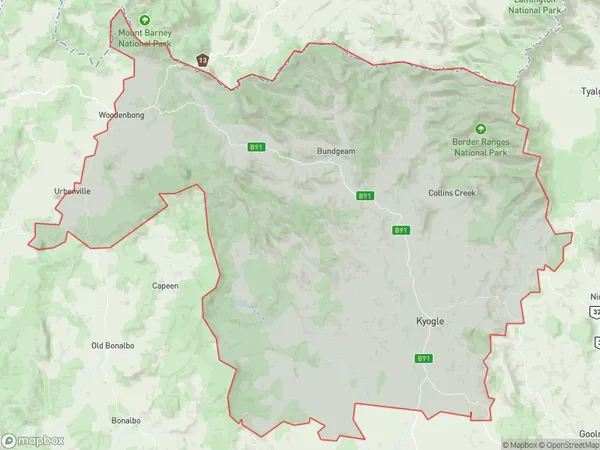
2470, 2474, 2476, and 2480 (In total, there are 4 postcodes in Kyogle.)Kyogle Suburb Area Map (Polygon)
Kyogle Introduction
Kyogle is a locality in the Richmond River Valley of New South Wales, Australia. It is located 366 kilometers north of Sydney and 125 kilometers south of the state capital, Brisbane. The town is situated on the banks of the Richmond River and is surrounded by lush forests and farmland. The population of Kyogle is approximately 5,000 people. The town has a variety of shops, cafes, and restaurants, as well as a hospital, a primary school, and a secondary school. The area is known for its agricultural productivity, with cotton, sugar cane, and bananas being the main crops grown. Kyogle is also home to a number of tourist attractions, including the Kyogle National Park, which is a popular spot for hiking, camping, and fishing. The town has a rich history, with evidence of early European settlement dating back to the 1830s. The town was named after the Kyogle River, which flows through the area. The river was named after the indigenous word "Kaiyugul," which means "watering place."Australia State
City or Big Region
Greater Capital City
Rest of NSW (1RNSW)District or Regional Area
Suburb Name
Kyogle Region Map
Kyogle Postcodes / Zip Codes
Kyogle Suburbs
Kyogle full address
Kyogle, Tweed Valley, Richmond Tweed, New South Wales, NSW, Australia, SaCode: 112021247Country
Kyogle, Tweed Valley, Richmond Tweed, New South Wales, NSW, Australia, SaCode: 112021247
Kyogle Suburbs & Region, Kyogle Map & Postcodes has 0 areas or regions above, and there are 60 Kyogle suburbs below. The sa2code for the Kyogle region is 112021247. Its latitude and longitude coordinates are -28.4182,152.583. Kyogle area belongs to Australia's greater capital city Rest of NSW.
Kyogle Suburbs & Localities
1. Barkers Vale
2. Cedar Point
3. Collins Creek
4. Green Pigeon
5. Homeleigh
6. Kilgra
7. Little Back Creek
8. New Park
9. Roseberry
10. Sherwood
11. Wadeville
12. Warrazambil Creek
13. Wiangaree
14. Wyneden
15. Brumby Plains
16. Boorabee Park
17. Babyl Creek
18. Doubtful Creek
19. Border Ranges
20. Cougal
21. Dairy Flat
22. Ettrick
23. Fawcetts Plain
24. Ghinni Ghi
25. Gradys Creek
26. Iron Pot Creek
27. Loadstone
28. Terrace Creek
29. The Risk
30. Unumgar
31. West Wiangaree
32. Muli Muli
33. The Glen
34. Lillian Rock
35. Woolners Arm
36. Cawongla
37. Eden Creek
38. Edenville
39. Findon Creek
40. Grevillia
41. Horse Station Creek
42. Horseshoe Creek
43. Kyogle
44. Lynchs Creek
45. Old Grevillia
46. Rukenvale
47. Sawpit Creek
48. Smiths Creek
49. Toonumbar
50. Upper Horseshoe Creek
51. Boomi Creek
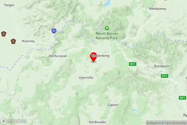
52. Woodenbong
53. Back Creek
54. Baraimal
55. Sextonville
56. Afterlee
57. Geneva
58. Roseberry Creek
59. Upper Eden Creek
60. Lindesay Creek