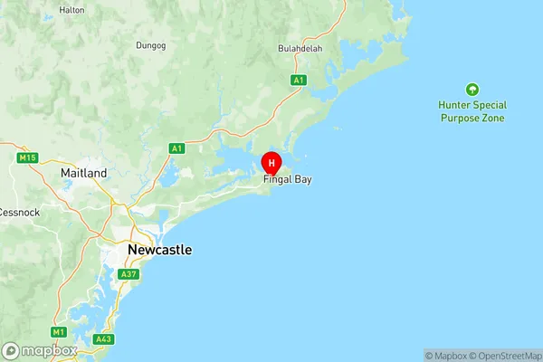
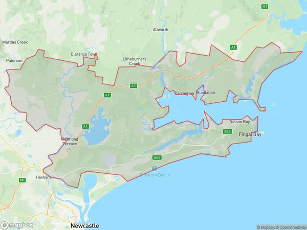
Port Stephens Suburbs & Region, Port Stephens Map & Postcodes
Port Stephens Suburbs & Region, Port Stephens Map & Postcodes in Port Stephens, Hunter Valley exc Newcastle, NSW, AU
Port Stephens Region
Region Name
Port Stephens (NSW, AU)Port Stephens Area
1072 square kilometers (1,072 ㎢)Postal Codes
from 2314 to 2317, and from 2319 to 2321 (In total, there are 7 postcodes in Port Stephens.)Port Stephens Introduction
Port Stephens is a coastal region located in the Hunter Valley, approximately 2 hours' drive north of Sydney, New South Wales, Australia. It is known for its stunning beaches, crystal-clear waters, and diverse marine life. The region is home to a number of popular tourist attractions, including the Nelson Bay Lighthouse, Stockton Beach, and the Tomaree National Park. Visitors can enjoy a range of activities, such as swimming, snorkeling, surfing, fishing, and hiking. The area is also famous for its wine production, with many wineries and cellar doors located in the surrounding countryside. Port Stephens is a great place to relax and unwind, with its beautiful natural surroundings and friendly locals.Australia State
City or Big Region
District or Regional Area
Port Stephens Region Map

Port Stephens Postcodes / Zip Codes
Port Stephens Suburbs
Lemon Tree Passage Tanilba Bay
Port Stephens full address
Port Stephens, Hunter Valley exc Newcastle, New South Wales, NSW, Australia, SaCode: 10603Country
Port Stephens, Hunter Valley exc Newcastle, New South Wales, NSW, Australia, SaCode: 10603
Port Stephens Suburbs & Region, Port Stephens Map & Postcodes has 4 areas or regions above, and there are 70 Port Stephens suburbs below. The sa3code for the Port Stephens region is 10603. Its latitude and longitude coordinates are -32.752,152.121.
Port Stephens Suburbs & Localities
1. Williamtown Raaf
2. Gan Gan
3. Nelson Bay
4. Shoal Bay
5. Anna Bay
6. Boat Harbour
7. Fishermans Bay
8. Bolwarra
9. Bolwarra Heights
10. Lorn
11. Louth Park
12. Maitland North
13. Rothbury
14. South Maitland
15. Telarah
16. Wallalong
17. Berry Park
18. Luskintyre
19. Morpeth
20. Woerden
21. Fingal Bay
22. Tanilba Bay
23. Anambah
24. Farley
25. Glen Oak
26. Hillsborough
27. Horseshoe Bend
28. Largs
29. Maitland
30. Oakhampton Heights
31. Pokolbin
32. Butterwick
33. Cliftleigh
34. Glen William
35. Phoenix Park
36. Raworth
37. Bobs Farm
38. One Mile
39. Taylors Beach
40. Salamander Bay
41. Soldiers Point
42. Aberglasslyn
43. Allandale
44. Gosforth
45. Maitland Vale
46. Melville
47. Mindaribba
48. Oakhampton
49. Rosebrook
50. Windella
51. Clarence Town
52. Duckenfield
53. Duns Creek
54. Glen Martin
55. Harpers Hill
56. Heddon Greta
57. Hinton
58. Woodville
59. Corlette
60. Lemon Tree Passage
61. Mallabula
62. Tilligerry Creek
63. Keinbah
64. Mount Dee
65. Rutherford
66. Gillieston Heights
67. Iona
68. Lochinvar
69. Oswald
70. Windermere
