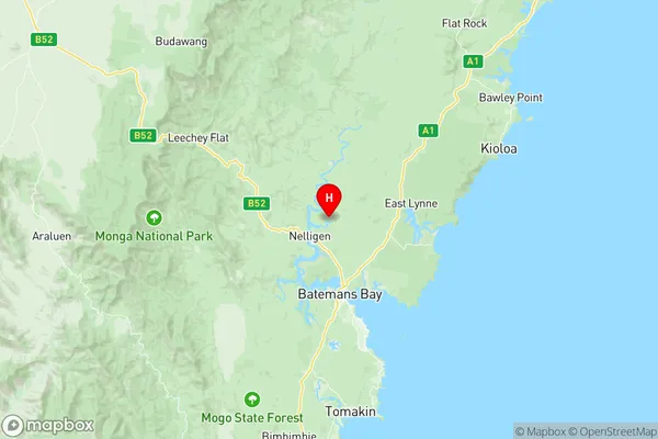
Eurobodalla Hinterland Suburbs & Region, Eurobodalla Hinterland Map & Postcodes
Eurobodalla Hinterland Suburbs & Region, Eurobodalla Hinterland Map & Postcodes in Eurobodalla Hinterland, South Coast, Capital Region, NSW, AU
Eurobodalla Hinterland Region
Region Name
Eurobodalla Hinterland (NSW, AU)Eurobodalla Hinterland Area
1460 square kilometers (1,460 ㎢)Postal Codes
2536, 2537, 2539, 2545, and 2622 (In total, there are 5 postcodes in Eurobodalla Hinterland.)Eurobodalla Hinterland Introduction
The Eurobodalla Hinterland is a region located in the South Coast of New South Wales, Australia. It is situated between the coastal towns of Batemans Bay and Moruya and is known for its stunning natural beauty, including pristine beaches, lush forests, and picturesque valleys. The region is home to a diverse range of wildlife, including kangaroos, wallabies, and koalas, and is a popular destination for outdoor enthusiasts, including hikers, surfers, and fishermen. The Eurobodalla Hinterland also boasts a rich cultural heritage, with numerous historic towns and villages, including Narooma, Bodalla, and Batemans Bay. The region is renowned for its delicious local produce, including fresh seafood, fruits, and vegetables, and is home to a number of wineries and breweries.Australia State
City or Big Region
Greater Capital City
Rest of NSW (1RNSW)District or Regional Area
Suburb Name
Eurobodalla Hinterland Region Map

Eurobodalla Hinterland Postcodes / Zip Codes
Eurobodalla Hinterland Suburbs
Eurobodalla Hinterland full address
Eurobodalla Hinterland, South Coast, Capital Region, New South Wales, NSW, Australia, SaCode: 101041024Country
Eurobodalla Hinterland, South Coast, Capital Region, New South Wales, NSW, Australia, SaCode: 101041024
Eurobodalla Hinterland Suburbs & Region, Eurobodalla Hinterland Map & Postcodes has 0 areas or regions above, and there are 29 Eurobodalla Hinterland suburbs below. The sa2code for the Eurobodalla Hinterland region is 101041024. Its latitude and longitude coordinates are -35.6315,150.165. Eurobodalla Hinterland area belongs to Australia's greater capital city Rest of NSW.
Eurobodalla Hinterland Suburbs & Localities
1. Benandarah
2. Bimbimbie
3. Buckenbowra
4. Currowan
5. Depot Beach
6. Durras North
7. East Lynne
8. Jeremadra
9. Merricumbene
10. Mogo
11. Murrengenburg
12. Nelligen
13. Pebbly Beach
14. Runnyford
15. South Durras
16. Woodlands
17. Deua River Valley
18. Kiora
19. Mogendoura
20. Turlinjah
21. Wamban
22. Cockwhy
23. Pretty Beach
24. Bodalla
25. Cadgee
26. Nerrigundah
27. Potato Point
28. Merricumbene
29. Murrengenburg
