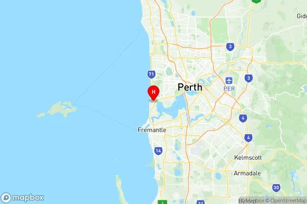
Cottesloe Suburbs & Region, Cottesloe Map & Postcodes
Cottesloe Suburbs & Region, Cottesloe Map & Postcodes in Cottesloe, Cottesloe Claremont, Perth Inner, WA, AU
Cottesloe Region
Region Name
Cottesloe (WA, AU)Cottesloe Area
3.75 square kilometers (3.75 ㎢)Postal Codes
6011, and 6911 (In total, there are 2 postcodes in Cottesloe.)Cottesloe Introduction
Cottesloe is a suburb of Perth, the capital city of Western Australia, and is located 8 kilometers (5 miles) northwest of Perth's central business district (CBD). It is known for its beautiful beaches, lush parks, and vibrant cultural scene. The suburb is named after Sir Walter Scott, a Scottish novelist who visited Western Australia in 1829 and was impressed by the area's natural beauty. Cottesloe is home to a large population of retirees and is popular with families due to its safe and peaceful environment. The suburb has a variety of shopping centers, restaurants, and cafes, as well as a medical center and a library. Cottesloe Beach is one of the most popular attractions in the area, with its white sand and crystal-clear waters attracting visitors from all over the world. The beach is also home to a variety of marine life, including dolphins, whales, and seals.Australia State
City or Big Region
Greater Capital City
Greater Perth (5GPER)District or Regional Area
Suburb Name
Cottesloe Region Map

Cottesloe Postcodes / Zip Codes
Cottesloe Suburbs
Cottesloe full address
Cottesloe, Cottesloe Claremont, Perth Inner, Western Australia, WA, Australia, SaCode: 503011032Country
Cottesloe, Cottesloe Claremont, Perth Inner, Western Australia, WA, Australia, SaCode: 503011032
Cottesloe Suburbs & Region, Cottesloe Map & Postcodes has 0 areas or regions above, and there are 2 Cottesloe suburbs below. The sa2code for the Cottesloe region is 503011032. Its latitude and longitude coordinates are -31.9897,115.763. Cottesloe area belongs to Australia's greater capital city Greater Perth.
Cottesloe Suburbs & Localities
1. Cottesloe
2. Cottesloe
