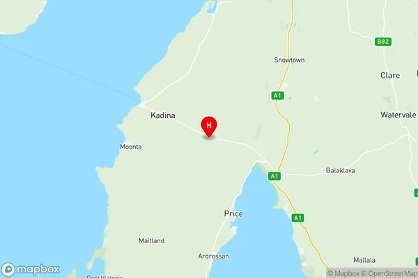
Yorke Peninsula Suburbs & Region, Yorke Peninsula Map & Postcodes
Yorke Peninsula Suburbs & Region, Yorke Peninsula Map & Postcodes in Yorke Peninsula, Barossa Yorke Mid North, SA, AU
Yorke Peninsula Region
Region Name
Yorke Peninsula (SA, AU)Yorke Peninsula Area
6741 square kilometers (6,741 ㎢)Postal Codes
5552, from 5554 to 5556, 5558, from 5570 to 5573, from 5575 to 5577, and from 5580 to 5583 (In total, there are 16 postcodes in Yorke Peninsula.)Yorke Peninsula Introduction
The Yorke Peninsula is a large peninsula located in South Australia, extending approximately 350 kilometers from the state's southern coast to the North Sea. It is known for its diverse range of landscapes, including rugged coastline, rolling hills, and fertile farmland. The peninsula is home to a number of popular tourist destinations, including the historic towns of Port Lincoln and Penola, as well as the world-renowned wine regions of the Barossa Valley and Clare Valley. The region is also known for its rich cultural heritage, with numerous museums and galleries showcasing the area's history and culture. The Yorke Peninsula is a popular destination for outdoor enthusiasts, with a variety of activities such as hiking, fishing, and surfing available.Australia State
City or Big Region
District or Regional Area
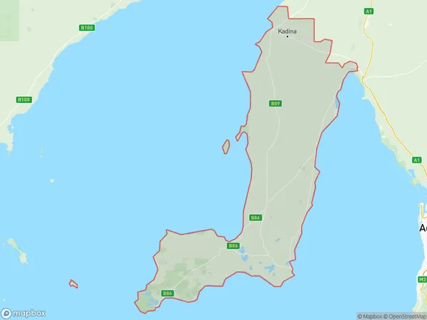
Yorke Peninsula Region Map

Yorke Peninsula Postcodes / Zip Codes
Yorke Peninsula Suburbs
Wakefield Barunga West
Yorke Peninsula North
Yorke Peninsula full address
Yorke Peninsula, Barossa Yorke Mid North, South Australia, SA, Australia, SaCode: 40504Country
Yorke Peninsula, Barossa Yorke Mid North, South Australia, SA, Australia, SaCode: 40504
Yorke Peninsula Suburbs & Region, Yorke Peninsula Map & Postcodes has 6 areas or regions above, and there are 111 Yorke Peninsula suburbs below. The sa3code for the Yorke Peninsula region is 40504. Its latitude and longitude coordinates are -34.0422,137.898.
Yorke Peninsula Suburbs & Localities
1. Kainton
2. Port Arthur
3. Jerusalem
4. Matta Flat
5. Dowlingville
6. Kulpara
7. Winulta
8. Paramatta
9. Port Hughes
10. Ardrossan
11. James Well
12. Arthurton
13. Port Arthur
14. Balgowan
15. Chinaman Wells
16. Point Pearce
17. Port Victoria
18. Bluff Beach
19. Koolywurtie
20. Port Julia
21. Kulpara
22. Cunliffe
23. Jericho
24. Melton
25. Warburto
26. Cross Roads
27. Hamley
28. Moonta
29. Moonta Mines
30. Nalyappa
31. North Moonta
32. North Yelta
33. Winulta
34. Sandilands
35. Chinamen Wells
36. South Kilkerran
37. Weetulta
38. Yorke Valley
39. Brentwood
40. Parsons Beach
41. Point Souttar
42. Stenhouse Bay
43. The Pines
44. Wool Bay
45. Couch Beach
46. Inneston
47. Point Souttar
48. Curramulka
49. Sultana Point
50. Ramsay
51. Yorketown
52. The Pines
53. Warooka
54. Port Julia
55. Sheaoak Flat
56. Paskeville
57. Sunnyvale
58. Thrington
59. Boors Plain
60. Kadina
61. Wallaroo Mines
62. Collinsfield
63. Melton
64. New Town
65. Thomas Plain
66. Thomas Plains
67. Hope Gap
68. Mundoora
69. North Beach
70. Wallaroo
71. Agery
72. East Moonta
73. Kooroona
74. Port Clinton
75. Price
76. Cunningham
77. Pine Point
78. Rogues Point
79. Urania
80. Wauraltee
81. Corny Point
82. Hardwicke Bay
83. Marion Bay
84. Minlaton
85. Port Vincent
86. Coobowie
87. Willamulka
88. Alford
89. Dowling
90. Lake View
91. Tickera
92. Wallaroo Plain
93. Moonta Bay
94. Yelta
95. Clinton
96. Clinton Centre
97. Black Point
98. Dowlingville
99. Petersville
100. Tiddy Widdy Beach
101. Maitland
102. Couch Beach
103. Point Turton
104. Port Rickaby
105. White Hut
106. Honiton
107. Port Moorowie
108. Foul Bay
109. Port Giles
110. Stansbury
111. Edithburgh
