Wakefield Barunga West Suburbs & Region, Wakefield Barunga West Map & Postcodes
Wakefield Barunga West Suburbs & Region, Wakefield Barunga West Map & Postcodes in Wakefield Barunga West, Yorke Peninsula, Barossa Yorke Mid North, SA, AU
Wakefield Barunga West Region
Region Name
Wakefield Barunga West (SA, AU)Wakefield Barunga West Area
5231 square kilometers (5,231 ㎢)Postal Codes
5401, 5453, from 5460 to 5462, 5464, 5501, 5510, 5520, 5522, 5523, 5550, 5552, 5554, 5555, and 5560 (In total, there are 16 postcodes in Wakefield Barunga West.)Wakefield Barunga West Suburb Area Map (Polygon)

Wakefield Barunga West Introduction
Wakefield Barunga West is a locality in the Barossa Valley, South Australia. It is located about 38 km north of Tanunda and 50 km south of Adelaide. The post office opened as Wakefield on 1 July 1885 and was closed on 1 March 1974. The name was changed to Barunga West on 1 July 1923. The town is named after the Barunga West railway station, which was opened on 1 October 1888. The railway station was closed on 1 October 1976. Barunga West is a farming community with a primary industry of grape growing and wine production. The town has a population of around 100 people.Australia State
City or Big Region
Greater Capital City
Rest of SA (4RSAU)District or Regional Area
Suburb Name
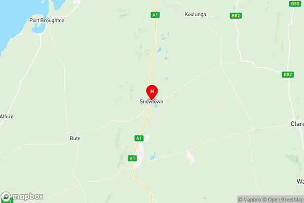
Wakefield Barunga West Region Map
Wakefield Barunga West Postcodes / Zip Codes
Wakefield Barunga West Suburbs
Wakefield Barunga West full address
Wakefield Barunga West, Yorke Peninsula, Barossa Yorke Mid North, South Australia, SA, Australia, SaCode: 405021119Country
Wakefield Barunga West, Yorke Peninsula, Barossa Yorke Mid North, South Australia, SA, Australia, SaCode: 405021119
Wakefield Barunga West Suburbs & Region, Wakefield Barunga West Map & Postcodes has 0 areas or regions above, and there are 60 Wakefield Barunga West suburbs below. The sa2code for the Wakefield Barunga West region is 405021119. Its latitude and longitude coordinates are -33.7831,138.216. Wakefield Barunga West area belongs to Australia's greater capital city Rest of SA.
Wakefield Barunga West Suburbs & Localities
2. Salter Springs
3. Stockyard Creek
4. Dalkey
5. Saints
7. Burnsfield
8. Beaufort
9. Kybunga
10. Kulpara
11. Condowie
12. Rochester
13. Wild Horse Plains
14. Barunga Gap
15. Clements Gap
16. Inkerman
17. Kallora
18. Port Wakefield
19. South Hummocks
20. Kulpara
21. Melton
22. Owen
23. Balaklava
24. Bowillia
25. Everard Central
26. Goyder
27. Halbury
28. Hoskin Corner
29. Mount Templeton
30. Watchman
31. Brinkworth
32. Lochiel
33. Bumbunga
34. Snowtown
35. Port Broughton
36. Hoyleton
37. Pinery
38. Erith
39. Stow
40. Whitwarta
41. Blyth
42. Marola
43. Avon
44. Gleeson Hill
45. Wokurna
46. Fisherman Bay
47. Ward Hill
48. Bowmans
49. Nantawarra
50. Proof Range
51. Melton
52. Thomas Plain
53. Hope Gap
54. Mundoora
55. Bute
56. Alford
57. Dowling
58. Lake View
59. Tickera
60. Ninnes