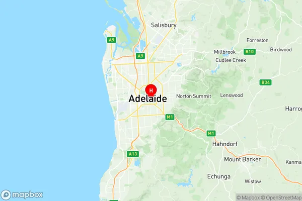
Adelaide Suburbs & Region, Adelaide Map & Postcodes
Adelaide Suburbs & Region, Adelaide Map & Postcodes in Adelaide, Adelaide City, Adelaide Central and Hills, SA, AU
Adelaide Region
Region Name
Adelaide (SA, AU)Adelaide Area
10.48 square kilometers (10.48 ㎢)Postal Codes
5000, 5001, 5005, 5800, 5810, and 5839 (In total, there are 6 postcodes in Adelaide.)Adelaide Introduction
Adelaide is the capital city of South Australia and the fifth-most populous city in Australia. It is located in the state's southeast corner and is known for its vibrant arts and culture scene, beautiful parks and gardens, and world-class food and wine. The city is home to a number of universities and colleges, including the University of South Australia and the Australian National University, and is a major center for research and innovation. Adelaide is also a popular tourist destination, with many visitors coming to explore its historic buildings, museums, and galleries.Australia State
City or Big Region
Greater Capital City
Greater Adelaide (4GADE)District or Regional Area
Suburb Name
Adelaide Region Map

Adelaide Postcodes / Zip Codes
Adelaide Suburbs
Adelaide full address
Adelaide, Adelaide City, Adelaide Central and Hills, South Australia, SA, Australia, SaCode: 401011001Country
Adelaide, Adelaide City, Adelaide Central and Hills, South Australia, SA, Australia, SaCode: 401011001
Adelaide Suburbs & Region, Adelaide Map & Postcodes has 0 areas or regions above, and there are 16 Adelaide suburbs below. The sa2code for the Adelaide region is 401011001. Its latitude and longitude coordinates are -34.9325,138.609. Adelaide area belongs to Australia's greater capital city Greater Adelaide.
Adelaide Suburbs & Localities
1. The University Of Adelaide
2. Adelaide
3. Adelaide Bc
4. Halifax Street
5. Station Arcade
6. University Of Adelaide
7. City West Campus
8. Rundle Mall
9. Hutt Street
10. Parliament House
11. Sturt Street
12. Adelaide
13. Adelaide University
14. Adelaide
15. Adelaide
16. Adelaide
