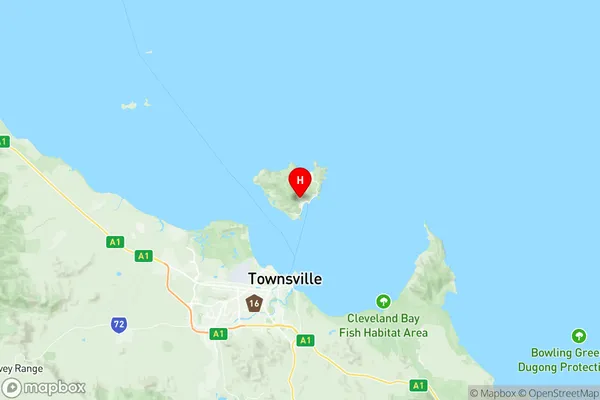
Magnetic Island Suburbs & Region, Magnetic Island Map & Postcodes
Magnetic Island Suburbs & Region, Magnetic Island Map & Postcodes in Magnetic Island, Townsville, QLD, AU
Magnetic Island Region
Region Name
Magnetic Island (QLD, AU)Magnetic Island Area
51.15 square kilometers (51.15 ㎢)Postal Codes
4819 (In total, there are 1 postcodes in Magnetic Island.)Magnetic Island Introduction
Magnetic Island is a popular tourist destination located off the coast of Townsville, Queensland, Australia. It is known for its beautiful beaches, coral reefs, and diverse wildlife. The island is car-free and accessible by ferry, making it a peaceful and relaxing getaway for visitors. There are several walking trails, picnic spots, and campgrounds on the island, as well as a range of accommodation options, including resorts, hotels, and holiday rentals. Magnetic Island is also home to a variety of animals, including koalas, wallabies, and sea turtles. The island has a rich history and was once inhabited by the indigenous Kauri people. It is also a popular filming location, with several movies and TV shows having been shot on the island.Australia State
City or Big Region
Greater Capital City
Rest of Qld (3RQLD)District or Regional Area
Suburb Name
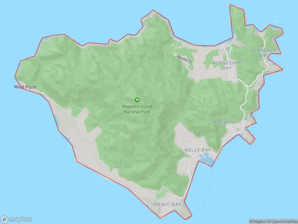
Magnetic Island Region Map

Magnetic Island Postcodes / Zip Codes
Magnetic Island Suburbs
Magnetic Island full address
Magnetic Island, Townsville, Queensland, QLD, Australia, SaCode: 318021483Country
Magnetic Island, Townsville, Queensland, QLD, Australia, SaCode: 318021483
Magnetic Island Suburbs & Region, Magnetic Island Map & Postcodes has 0 areas or regions above, and there are 8 Magnetic Island suburbs below. The sa2code for the Magnetic Island region is 318021483. Its latitude and longitude coordinates are -19.1547,146.845. Magnetic Island area belongs to Australia's greater capital city Rest of Qld.
Magnetic Island Suburbs & Localities
1. Arcadia
2. Magnetic Island
3. Picnic Bay
4. Florence Bay
5. West Point
6. Arcadia Bay
7. Horseshoe Bay
8. Nelly Bay
