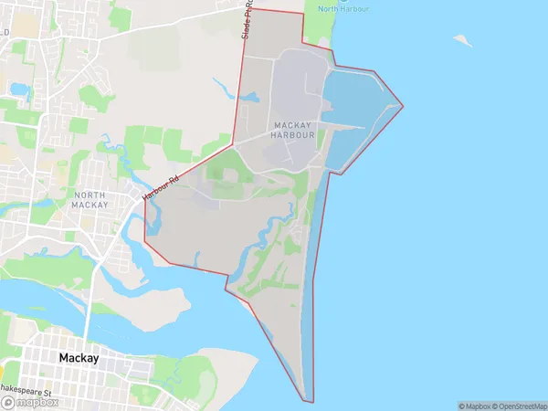
Mackay Harbour Suburbs & Region, Mackay Harbour Map & Postcodes
Mackay Harbour Suburbs & Region, Mackay Harbour Map & Postcodes in Mackay Harbour, Mackay, Mackay Isaac Whitsunday, QLD, AU
Mackay Harbour Region
Region Name
Mackay Harbour (QLD, AU)Mackay Harbour Area
10.17 square kilometers (10.17 ㎢)Mackay Harbour Introduction
Mackay Harbour is a large natural harbor located in the city of Mackay, Queensland, Australia. It is the second-largest harbor in Australia and serves as a major port for the export of coal, sugar, and other commodities. The harbor is also a popular tourist destination, with many visitors coming to see the stunning natural beauty of the surrounding area, including the Great Barrier Reef and the Whitsunday Islands. The harbor is home to a variety of marine species, including dolphins, whales, and sharks. It is also a major shipping hub, with several ships arriving and departing daily.Australia State
City or Big Region
Greater Capital City
Rest of Qld (3RQLD)District or Regional Area
Suburb Name
Mackay Harbour Suburbs
Mackay Harbour full address
Mackay Harbour, Mackay, Mackay Isaac Whitsunday, Queensland, QLD, Australia, SaCode: 312021347Country
Mackay Harbour, Mackay, Mackay Isaac Whitsunday, Queensland, QLD, Australia, SaCode: 312021347
Mackay Harbour Suburbs & Region, Mackay Harbour Map & Postcodes has 0 areas or regions above, and there are 0 Mackay Harbour suburbs below. The sa2code for the Mackay Harbour region is 312021347. Mackay Harbour area belongs to Australia's greater capital city Rest of Qld.
