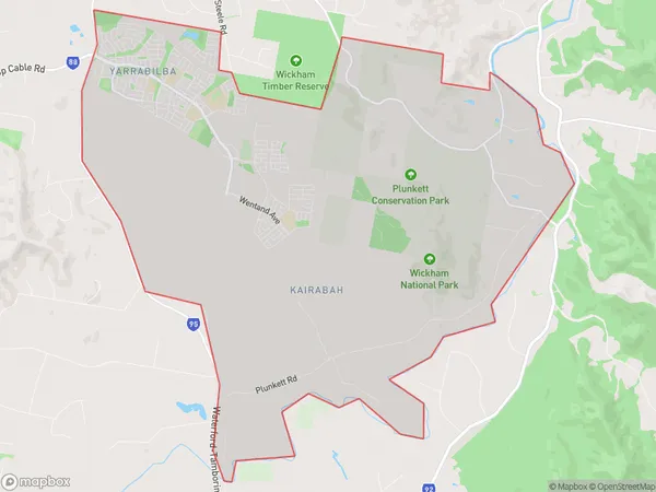
Yarrabilba Suburbs & Region, Yarrabilba Map & Postcodes
Yarrabilba Suburbs & Region, Yarrabilba Map & Postcodes in Yarrabilba, Jimboomba, Logan Beaudesert, QLD, AU
Yarrabilba Region
Region Name
Yarrabilba (QLD, AU)Yarrabilba Area
39.07 square kilometers (39.07 ㎢)Yarrabilba Introduction
Yarrabilba is a locality in the City of Logan, Queensland, Australia. It is part of the South East Queensland region. At the 2011 Australian census, Yarrabilba recorded a population of 5,181 people. The locality is named after the Yarrabilba Creek, which flows through it. The creek is a tributary of the Logan River. The area was first settled in the 1860s by timber getters and farmers. The town was established in the 1880s and was named after the Yarrabilba railway station, which was opened in 1889. Yarrabilba is a popular residential area with a variety of housing options, including single-family homes, townhouses, and apartments. The town has a number of parks and recreational facilities, including a golf course, cricket club, and swimming pool. The area is also home to a number of businesses, including a supermarket, pharmacy, and medical centre. Yarrabilba is located approximately 25 kilometres south-west of the Brisbane CBD and is serviced by the Logan City Bus Service. The town is also well-connected to the motorway network, with the Pacific Motorway and the M1 motorway both accessible from the town.Australia State
City or Big Region
Greater Capital City
Greater Brisbane (3GBRI)District or Regional Area
Suburb Name
Yarrabilba Suburbs
Yarrabilba full address
Yarrabilba, Jimboomba, Logan Beaudesert, Queensland, QLD, Australia, SaCode: 311041571Country
Yarrabilba, Jimboomba, Logan Beaudesert, Queensland, QLD, Australia, SaCode: 311041571
Yarrabilba Suburbs & Region, Yarrabilba Map & Postcodes has 0 areas or regions above, and there are 0 Yarrabilba suburbs below. The sa2code for the Yarrabilba region is 311041571. Yarrabilba area belongs to Australia's greater capital city Greater Brisbane.
