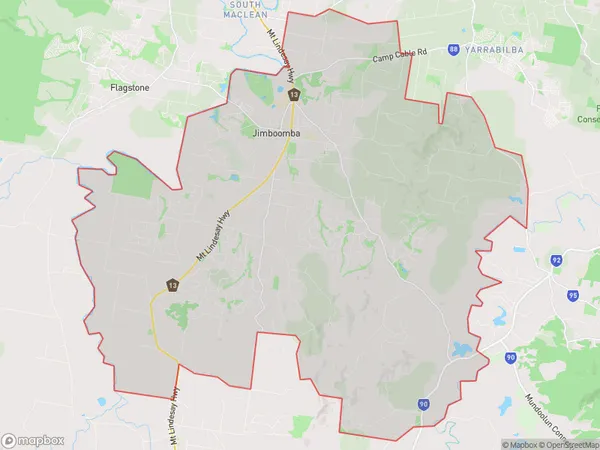
Jimboomba Glenlogan Suburbs & Region, Jimboomba Glenlogan Map & Postcodes
Jimboomba Glenlogan Suburbs & Region, Jimboomba Glenlogan Map & Postcodes in Jimboomba Glenlogan, Jimboomba, Logan Beaudesert, QLD, AU
Jimboomba Glenlogan Region
Region Name
Jimboomba Glenlogan (QLD, AU)Jimboomba Glenlogan Area
181.67 square kilometers (181.67 ㎢)Jimboomba Glenlogan Introduction
Jimboomba Glenlogan is a locality in the City of Logan, Queensland, Australia. It is located 22 kilometers south of the Logan City center. The locality is named after the Jimboomba Creek, which flows through it. It is a popular residential area with a variety of housing styles, including single-family homes, duplexes, and apartments. The area has a number of parks and recreational facilities, including a golf course, a swimming pool, and a skate park. It is also home to a number of businesses, including a shopping center and a medical center.Australia State
City or Big Region
Greater Capital City
Greater Brisbane (3GBRI)District or Regional Area
Suburb Name
Jimboomba Glenlogan Suburbs
Jimboomba Glenlogan full address
Jimboomba Glenlogan, Jimboomba, Logan Beaudesert, Queensland, QLD, Australia, SaCode: 311041570Country
Jimboomba Glenlogan, Jimboomba, Logan Beaudesert, Queensland, QLD, Australia, SaCode: 311041570
Jimboomba Glenlogan Suburbs & Region, Jimboomba Glenlogan Map & Postcodes has 0 areas or regions above, and there are 0 Jimboomba Glenlogan suburbs below. The sa2code for the Jimboomba Glenlogan region is 311041570. Jimboomba Glenlogan area belongs to Australia's greater capital city Greater Brisbane.
