Carole Park Suburbs & Region, Carole Park Map & Postcodes
Carole Park Suburbs & Region, Carole Park Map & Postcodes in Carole Park, Springfield Redbank, Ipswich, QLD, AU
Carole Park Region
Region Name
Carole Park (QLD, AU)Carole Park Area
4.03 square kilometers (4.03 ㎢)Postal Codes
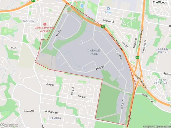
4300 (In total, there are 1 postcodes in Carole Park.)Carole Park Suburb Area Map (Polygon)
Carole Park Introduction
Carole Park is a locality in the City of Ipswich, Queensland, Australia. It is located 10 kilometers west of the Ipswich central business district. Carole Park has a population of around 2,500 people and is known for its large number of parks and recreational facilities. The park includes a playground, picnic areas, walking tracks, and a cricket oval. The suburb also has a shopping center, a medical center, and a number of schools. Carole Park is surrounded by other suburbs, including Brassall, Redbank Plains, and West Ipswich. The area is well-serviced by public transport, with buses and trains running regularly to the city center.Australia State
City or Big Region
Greater Capital City
Greater Brisbane (3GBRI)District or Regional Area
Suburb Name
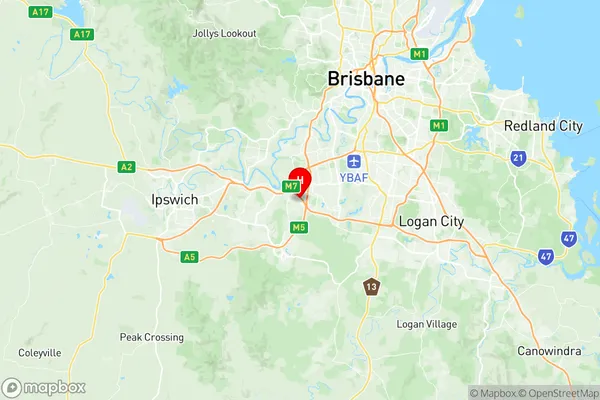
Carole Park Region Map
Carole Park Postcodes / Zip Codes
Carole Park Suburbs
Carole Park full address
Carole Park, Springfield Redbank, Ipswich, Queensland, QLD, Australia, SaCode: 310041298Country
Carole Park, Springfield Redbank, Ipswich, Queensland, QLD, Australia, SaCode: 310041298
Carole Park Suburbs & Region, Carole Park Map & Postcodes has 0 areas or regions above, and there are 1 Carole Park suburbs below. The sa2code for the Carole Park region is 310041298. Its latitude and longitude coordinates are -27.6167,152.933. Carole Park area belongs to Australia's greater capital city Greater Brisbane.
Carole Park Suburbs & Localities
1. Carole Park