Springfield Redbank Suburbs & Region, Springfield Redbank Map & Postcodes
Springfield Redbank Suburbs & Region, Springfield Redbank Map & Postcodes in Springfield Redbank, Ipswich, QLD, AU
Springfield Redbank Region
Region Name
Springfield Redbank (QLD, AU)Springfield Redbank Area
103.59 square kilometers (103.59 ㎢)Postal Codes
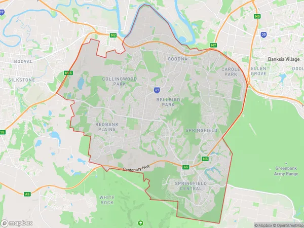
4300, 4301, and 4303 (In total, there are 3 postcodes in Springfield Redbank.)Springfield Redbank Suburb Area Map (Polygon)
Springfield Redbank Introduction
Springfield Redbank is a locality in the City of Ipswich, Queensland, Australia. It is located 10 kilometers west of the Ipswich central business district. The suburb has a population of around 5,000 people and is known for its large number of parks and recreational facilities. It is also home to the Springfield Shopping Centre and the Redbank Plains Sports Complex.Australia State
City or Big Region
District or Regional Area
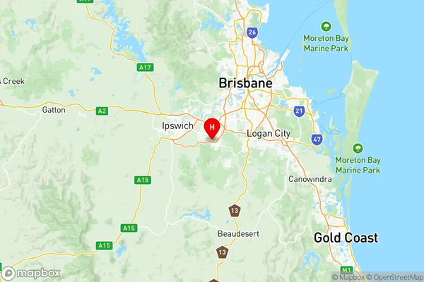
Springfield Redbank Region Map
Springfield Redbank Postcodes / Zip Codes
Springfield Redbank Suburbs
Bellbird Park Brookwater
Collingwood Park Redbank
Redbank Plains
Springfield Lakes
Augustine Heights Brookwater
Springfield Redbank full address
Springfield Redbank, Ipswich, Queensland, QLD, Australia, SaCode: 31004Country
Springfield Redbank, Ipswich, Queensland, QLD, Australia, SaCode: 31004
Springfield Redbank Suburbs & Region, Springfield Redbank Map & Postcodes has 12 areas or regions above, and there are 21 Springfield Redbank suburbs below. The sa3code for the Springfield Redbank region is 31004. Its latitude and longitude coordinates are -27.6692,152.894.
Springfield Redbank Suburbs & Localities
1. Augustine Heights
2. Brookwater
3. Goodna
4. Goodna Dc
5. Opossum Creek
6. Spring Mountain
7. Springfield
8. Dinmore
9. Gailes
10. Goodna East
11. Collingwood Park
12. New Chum
13. Bellbird Park
14. Springfield Lakes
15. Greenwood Village
16. Redbank Plains
17. Camira
18. Carole Park
19. Springfield Central
20. Redbank
21. Riverview