Esk Suburbs & Region, Esk Map & Postcodes
Esk Suburbs & Region, Esk Map & Postcodes in Esk, Caboolture Hinterland, Moreton Bay North, QLD, AU
Esk Region
Region Name
Esk (QLD, AU)Esk Area
1890 square kilometers (1,890 ㎢)Postal Codes
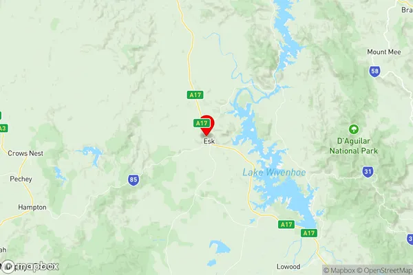
4306, and from 4311 to 4313 (In total, there are 4 postcodes in Esk.)Esk Suburb Area Map (Polygon)

Esk Introduction
Esk is a locality in the Moreton Bay Region, Queensland, Australia. It is part of the City of Caboolture. At the 2011 Australian census, Esk recorded a population of 4,213. Esk is a rural locality with a mixture of farming and residential properties. It is located approximately 25 kilometers north of Caboolture and has a post office, a primary school, a pub, and a community hall. The Esk River flows through the locality and is a popular spot for fishing and swimming. The surrounding area is known for its agricultural productivity, with crops such as sugarcane, cotton, and tomatoes being grown in the region.Australia State
City or Big Region
Greater Capital City
Greater Brisbane (3GBRI)District or Regional Area
Suburb Name
Esk Region Map
Esk Postcodes / Zip Codes
Esk Suburbs
Esk full address
Esk, Caboolture Hinterland, Moreton Bay North, Queensland, QLD, Australia, SaCode: 310021278Country
Esk, Caboolture Hinterland, Moreton Bay North, Queensland, QLD, Australia, SaCode: 310021278
Esk Suburbs & Region, Esk Map & Postcodes has 0 areas or regions above, and there are 27 Esk suburbs below. The sa2code for the Esk region is 310021278. Its latitude and longitude coordinates are -27.2333,152.417. Esk area belongs to Australia's greater capital city Greater Brisbane.
Esk Suburbs & Localities
1. Dundas
2. Caboonbah
3. Coal Creek
4. Crossdale
5. Cooeeimbardi
6. Ottaba
7. Buaraba
8. Bryden
9. Eskdale
10. Moombra
11. Mount Hallen
12. Cressbrook
13. Lower Cressbrook
14. Mount Beppo
15. Scrub Creek
16. Toogoolawah
17. Mount Byron
18. Somerset Dam
19. Braemore
20. Fulham
21. Ivory Creek
22. Esk
23. Glen Esk
24. Murrumba
25. Redbank Creek
26. Biarra
27. Yimbun