Coolangatta Suburbs & Region, Coolangatta Map & Postcodes
Coolangatta Suburbs & Region, Coolangatta Map & Postcodes in Coolangatta, Gold Coast, QLD, AU
Coolangatta Region
Region Name
Coolangatta (QLD, AU)Coolangatta Area
1.9 square kilometers (1.9 ㎢)Postal Codes
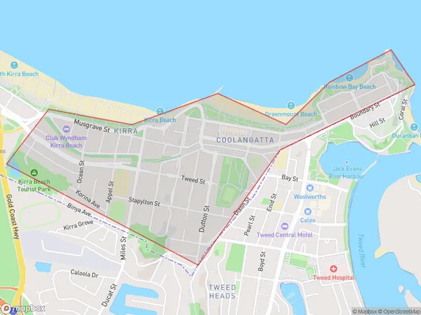
4225 (In total, there are 1 postcodes in Coolangatta.)Coolangatta Suburb Area Map (Polygon)
Coolangatta Introduction
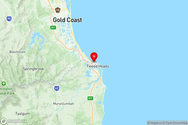
Coolangatta is a coastal suburb in the City of Gold Coast, Queensland, Australia. It is located 68 kilometers south of the state capital, Brisbane, and is part of the Greater South East region. Coolangatta is known for its beautiful beaches, vibrant nightlife, and as a popular tourist destination. The suburb has a population of approximately 20,000 people and is home to several iconic landmarks, including the Coolangatta Beach, the Gold Coast Convention and Exhibition Centre, and the Q1 Building.Australia State
City or Big Region
Greater Capital City
Rest of Qld (3RQLD)District or Regional Area
Suburb Name
Coolangatta Region Map
Coolangatta Postcodes / Zip Codes
Coolangatta Suburbs
Coolangatta full address
Coolangatta, Gold Coast, Queensland, QLD, Australia, SaCode: 309021230Country
Coolangatta, Gold Coast, Queensland, QLD, Australia, SaCode: 309021230
Coolangatta Suburbs & Region, Coolangatta Map & Postcodes has 0 areas or regions above, and there are 2 Coolangatta suburbs below. The sa2code for the Coolangatta region is 309021230. Its latitude and longitude coordinates are -28.1674,153.531. Coolangatta area belongs to Australia's greater capital city Rest of Qld.
Coolangatta Suburbs & Localities
1. Coolangatta
2. Kirra