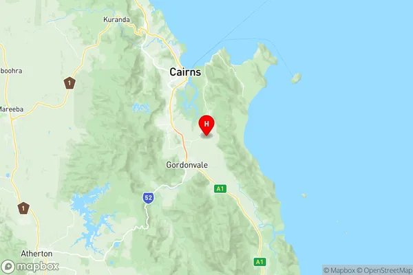
Gordonvale Trinity Suburbs & Region, Gordonvale Trinity Map & Postcodes
Gordonvale Trinity Suburbs & Region, Gordonvale Trinity Map & Postcodes in Gordonvale Trinity, Outback North, Queensland Outback, QLD, AU
Gordonvale Trinity Region
Region Name
Gordonvale Trinity (QLD, AU)Gordonvale Trinity Area
327.09 square kilometers (327.09 ㎢)Postal Codes
4865, 4869, and 4871 (In total, there are 3 postcodes in Gordonvale Trinity.)Gordonvale Trinity Introduction
Gordonvale Trinity is a church located in the Outback town of Gordonvale, Queensland, Australia. It is a significant part of the local community and is known for its beautiful architecture and historic significance. The church was built in 1928 and is made of wood and stone. It has a steeple that rises high above the town, and the interior is decorated with stained glass windows and intricate woodwork. The church is a popular tourist attraction and is often used for weddings and other religious ceremonies.Australia State
City or Big Region
Greater Capital City
Rest of Qld (3RQLD)District or Regional Area
Suburb Name
Gordonvale Trinity Region Map

Gordonvale Trinity Postcodes / Zip Codes
Gordonvale Trinity Suburbs
Gordonvale Trinity full address
Gordonvale Trinity, Outback North, Queensland Outback, Queensland, QLD, Australia, SaCode: 306021148Country
Gordonvale Trinity, Outback North, Queensland Outback, Queensland, QLD, Australia, SaCode: 306021148
Gordonvale Trinity Suburbs & Region, Gordonvale Trinity Map & Postcodes has 0 areas or regions above, and there are 18 Gordonvale Trinity suburbs below. The sa2code for the Gordonvale Trinity region is 306021148. Its latitude and longitude coordinates are -17.0459,145.815. Gordonvale Trinity area belongs to Australia's greater capital city Rest of Qld.
Gordonvale Trinity Suburbs & Localities
1. Little Mulgrave
2. Wrights Creek
3. Kurrimine Beach
4. South Wellesley Islands
5. Wellesley Islands
6. Goldsborough
7. Packers Camp
8. Pyramid
9. Mount Peter
10. Gordonvale
11. East Trinity
12. Green Island
13. West Wellesley Islands
14. Green Hill
15. Kamma
16. Meringa
17. Fitzroy Island
18. Glen Boughton
