Bulimba Suburbs & Region, Bulimba Map & Postcodes
Bulimba Suburbs & Region, Bulimba Map & Postcodes in Bulimba, Brisbane Inner East, Brisbane Inner City, QLD, AU
Bulimba Region
Region Name
Bulimba (QLD, AU)Bulimba Area
2.06 square kilometers (2.06 ㎢)Postal Codes
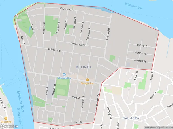
4171 (In total, there are 1 postcodes in Bulimba.)Bulimba Suburb Area Map (Polygon)
Bulimba Introduction
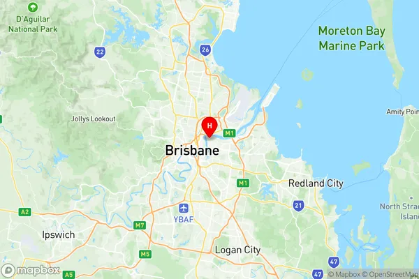
Bulimba is a suburb in the City of Brisbane, Queensland, Australia. It is located 5 kilometers (3.1 mi) from the Brisbane CBD and is part of the inner-city region. The suburb is named after the Bulimba Creek, which flows through it. Bulimba is known for its vibrant cultural scene, with a large number of restaurants, cafes, and bars. It is also home to the Bulimba Arts Centre, which hosts a variety of events and exhibitions throughout the year. The suburb has a mixed population, with a significant number of immigrants from Asia, Africa, and the Middle East. It is also home to a large number of university students, due to its proximity to the Queensland University of Technology. Bulimba is well-connected to public transport, with several bus and train stations located within the suburb. It is also within walking distance of the Brisbane River, which offers a range of recreational activities.Australia State
City or Big Region
Greater Capital City
Greater Brisbane (3GBRI)District or Regional Area
Suburb Name
Bulimba Region Map
Bulimba Postcodes / Zip Codes
Bulimba Suburbs
Bulimba full address
Bulimba, Brisbane Inner East, Brisbane Inner City, Queensland, QLD, Australia, SaCode: 305021114Country
Bulimba, Brisbane Inner East, Brisbane Inner City, Queensland, QLD, Australia, SaCode: 305021114
Bulimba Suburbs & Region, Bulimba Map & Postcodes has 0 areas or regions above, and there are 1 Bulimba suburbs below. The sa2code for the Bulimba region is 305021114. Its latitude and longitude coordinates are -27.45,153.058. Bulimba area belongs to Australia's greater capital city Greater Brisbane.
Bulimba Suburbs & Localities
1. Bulimba