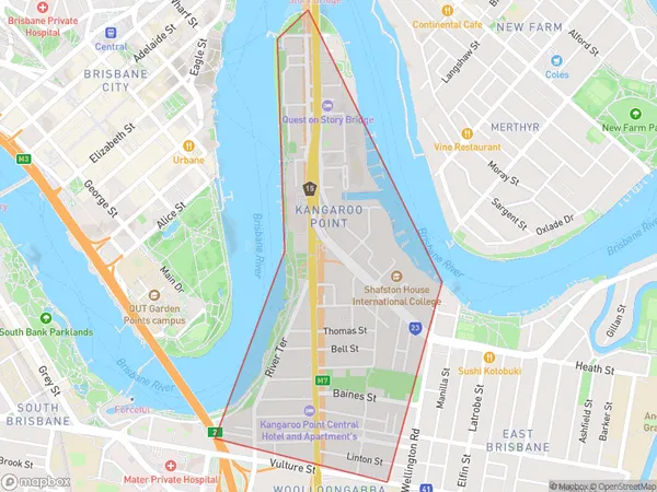
Kangaroo Point Suburbs & Region, Kangaroo Point Map & Postcodes
Kangaroo Point Suburbs & Region, Kangaroo Point Map & Postcodes in Kangaroo Point, Brisbane Inner, Brisbane Inner City, QLD, AU
Kangaroo Point Region
Region Name
Kangaroo Point (QLD, AU)Kangaroo Point Area
1.34 square kilometers (1.34 ㎢)Kangaroo Point Introduction
Kangaroo Point is a suburb in the City of Brisbane, Queensland, Australia. It is located 4 km southeast of the Brisbane CBD and is bounded by the Brisbane River to the north, Main Street to the east, and Stanley Street to the south. The suburb is known for its historic buildings, including the Kangaroo Point Cliffs and the Story Bridge. It is also home to the Kangaroo Point Cliffs Park, which offers panoramic views of the city skyline and the Brisbane River. The area is popular with tourists and locals alike and is known for its vibrant nightlife and cultural attractions.Australia State
City or Big Region
Greater Capital City
Greater Brisbane (3GBRI)District or Regional Area
Suburb Name
Kangaroo Point Suburbs
Kangaroo Point full address
Kangaroo Point, Brisbane Inner, Brisbane Inner City, Queensland, QLD, Australia, SaCode: 305011108Country
Kangaroo Point, Brisbane Inner, Brisbane Inner City, Queensland, QLD, Australia, SaCode: 305011108
Kangaroo Point Suburbs & Region, Kangaroo Point Map & Postcodes has 0 areas or regions above, and there are 0 Kangaroo Point suburbs below. The sa2code for the Kangaroo Point region is 305011108. Kangaroo Point area belongs to Australia's greater capital city Greater Brisbane.
