Carina Heights Suburbs & Region, Carina Heights Map & Postcodes
Carina Heights Suburbs & Region, Carina Heights Map & Postcodes in Carina Heights, Brisbane Inner East, Brisbane Inner City, QLD, AU
Carina Heights Region
Region Name
Carina Heights (QLD, AU)Carina Heights Area
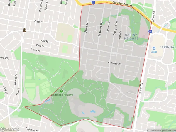
3.4 square kilometers (3.4 ㎢)Postal Codes
4152 (In total, there are 1 postcodes in Carina Heights.)Carina Heights Suburb Area Map (Polygon)
Carina Heights Introduction
Carina Heights is a suburb in the City of Brisbane, Queensland, Australia. It is located 6 kilometers southeast of the Brisbane CBD and is part of the Brisbane Inner City region. The suburb is named after the Carina River, which flows through it. Carina Heights is a diverse suburb with a mix of residential, commercial, and industrial areas. It is home to a large number of ethnic communities, including Greeks, Italians, and Asians, and has a number of cultural institutions and landmarks. The suburb is well-serviced by public transport, with several bus routes and a train station located within its boundaries. It is also home to several parks and recreational facilities, including a golf course, swimming pools, and a sports complex.Australia State
City or Big Region
Greater Capital City
Greater Brisbane (3GBRI)District or Regional Area
Suburb Name
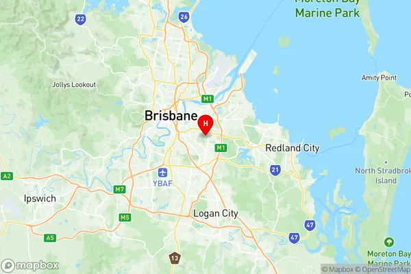
Carina Heights Region Map
Carina Heights Postcodes / Zip Codes
Carina Heights Suburbs
Carina Heights full address
Carina Heights, Brisbane Inner East, Brisbane Inner City, Queensland, QLD, Australia, SaCode: 303011050Country
Carina Heights, Brisbane Inner East, Brisbane Inner City, Queensland, QLD, Australia, SaCode: 303011050
Carina Heights Suburbs & Region, Carina Heights Map & Postcodes has 0 areas or regions above, and there are 1 Carina Heights suburbs below. The sa2code for the Carina Heights region is 303011050. Its latitude and longitude coordinates are -27.507,153.093. Carina Heights area belongs to Australia's greater capital city Greater Brisbane.
Carina Heights Suburbs & Localities
1. Carina Heights