Wavell Heights Suburbs & Region, Wavell Heights Map & Postcodes
Wavell Heights Suburbs & Region, Wavell Heights Map & Postcodes in Wavell Heights, Brisbane Inner North, Brisbane Inner City, QLD, AU
Wavell Heights Region
Region Name
Wavell Heights (QLD, AU)Wavell Heights Area
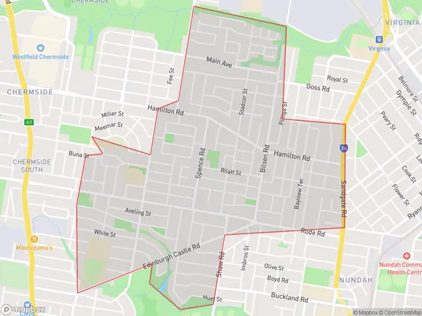
3.58 square kilometers (3.58 ㎢)Postal Codes
4012 (In total, there are 1 postcodes in Wavell Heights.)Wavell Heights Suburb Area Map (Polygon)
Wavell Heights Introduction
Wavell Heights is a suburb in the City of Brisbane, Queensland, Australia. It is located 5 kilometers northwest of the Brisbane CBD and is part of the Inner City. Wavell Heights has a rich history and was named after Sir William Wavell, a British general who served in Australia during World War I. The suburb has a diverse population and is known for its multiculturalism, with many residents from different countries and cultures. It is home to a number of parks and recreational facilities, including Wavell Heights Park, which features a playground, picnic areas, and a walking trail. The suburb is also home to a number of schools, including Wavell Heights State School and Wavell Heights State College.Australia State
City or Big Region
Greater Capital City
Greater Brisbane (3GBRI)District or Regional Area
Suburb Name
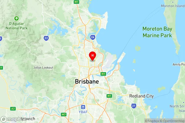
Wavell Heights Region Map
Wavell Heights Postcodes / Zip Codes
Wavell Heights Suburbs
Wavell Heights full address
Wavell Heights, Brisbane Inner North, Brisbane Inner City, Queensland, QLD, Australia, SaCode: 302021034Country
Wavell Heights, Brisbane Inner North, Brisbane Inner City, Queensland, QLD, Australia, SaCode: 302021034
Wavell Heights Suburbs & Region, Wavell Heights Map & Postcodes has 0 areas or regions above, and there are 2 Wavell Heights suburbs below. The sa2code for the Wavell Heights region is 302021034. Its latitude and longitude coordinates are -27.3897,153.049. Wavell Heights area belongs to Australia's greater capital city Greater Brisbane.
Wavell Heights Suburbs & Localities
1. Wavell Heights
2. Wavell Heights North