Stafford Suburbs & Region, Stafford Map & Postcodes
Stafford Suburbs & Region, Stafford Map & Postcodes in Stafford, Hills District, Moreton Bay South, QLD, AU
Stafford Region
Region Name
Stafford (QLD, AU)Stafford Area
3.44 square kilometers (3.44 ㎢)Postal Codes
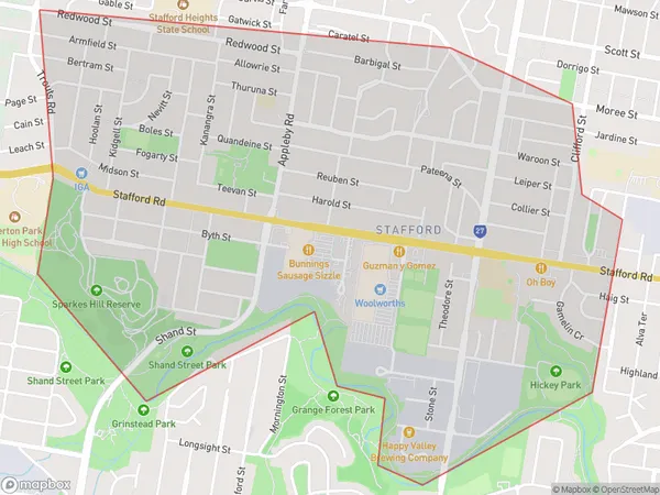
4053 (In total, there are 1 postcodes in Stafford.)Stafford Suburb Area Map (Polygon)
Stafford Introduction
Stafford is a suburb in the City of Brisbane, Queensland, Australia. It is located 7 kilometers south of the Brisbane CBD and is part of the Moreton Bay Region. The suburb has a population of around 21,000 people and is known for its suburban lifestyle and proximity to the Brisbane River. Stafford has a variety of shops, restaurants, and recreational facilities, including a shopping center, a library, and several parks. The suburb is also home to several major transport routes, including the Pacific Motorway and the Gateway Motorway.Australia State
City or Big Region
Greater Capital City
Greater Brisbane (3GBRI)District or Regional Area
Suburb Name
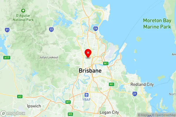
Stafford Region Map
Stafford Postcodes / Zip Codes
Stafford Suburbs
Stafford full address
Stafford, Hills District, Moreton Bay South, Queensland, QLD, Australia, SaCode: 302021032Country
Stafford, Hills District, Moreton Bay South, Queensland, QLD, Australia, SaCode: 302021032
Stafford Suburbs & Region, Stafford Map & Postcodes has 0 areas or regions above, and there are 4 Stafford suburbs below. The sa2code for the Stafford region is 302021032. Its latitude and longitude coordinates are -27.4185,153.014. Stafford area belongs to Australia's greater capital city Greater Brisbane.
Stafford Suburbs & Localities
1. Stafford Bc
2. Stafford
3. Stafford Dc
4. Stafford City