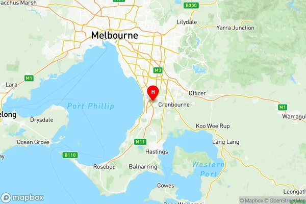
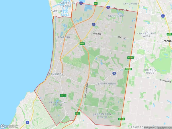
Frankston Suburbs & Region, Frankston Map & Postcodes
Frankston Suburbs & Region, Frankston Map & Postcodes in Frankston, Mornington Peninsula, VIC, AU
Frankston Region
Region Name
Frankston (VIC, AU)Frankston Area
129.6 square kilometers (129.6 ㎢)Postal Codes
3197, 3198, 3200, 3201, 3910, and 3977 (In total, there are 6 postcodes in Frankston.)Frankston Introduction
Frankston is a suburb of Melbourne, Victoria, Australia, located 56 km southeast of the Melbourne central business district. It is part of the City of Frankston local government area. At the 2016 census, Frankston had a population of 36,448. The suburb is named after Frankston, Victoria, the birthplace of the first Premier of Victoria, Sir John Macdonald. Frankston is known for its beaches, parks, and recreational facilities, including the Frankston Arts Centre and the Frankston Aquatic Centre. It is also home to several major industries, including manufacturing, logistics, and tourism.Australia State
City or Big Region
District or Regional Area
Frankston Region Map

Frankston Postcodes / Zip Codes
Frankston Suburbs
Carrum Patterson Lakes
Cranbourne North
Cranbourne West
Frankston North
Frankston full address
Frankston, Mornington Peninsula, Victoria, VIC, Australia, SaCode: 21401Country
Frankston, Mornington Peninsula, Victoria, VIC, Australia, SaCode: 21401
Frankston Suburbs & Region, Frankston Map & Postcodes has 8 areas or regions above, and there are 20 Frankston suburbs below. The sa3code for the Frankston region is 21401. Its latitude and longitude coordinates are -38.0975,145.171.
Frankston Suburbs & Localities
1. Carrum
2. Pines Forest
3. Frankston North
4. Carrum Downs
5. Patterson Lakes
6. Belvedere Park
7. Seaford
8. Langwarrin
9. Botanic Ridge
10. Sandhurst
11. Cranbourne East
12. Cranbourne North
13. Cranbourne South
14. Cranbourne West
15. Cannons Creek
16. Cranbourne
17. Devon Meadows
18. Five Ways
19. Junction Village
20. Skye
