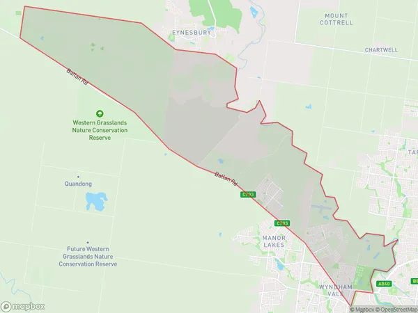
Wyndham Vale North Suburbs & Region, Wyndham Vale North Map & Postcodes
Wyndham Vale North Suburbs & Region, Wyndham Vale North Map & Postcodes in Wyndham Vale North, Wyndham, Melbourne West, VIC, AU
Wyndham Vale North Region
Region Name
Wyndham Vale North (VIC, AU)Wyndham Vale North Area
51.25 square kilometers (51.25 ㎢)Wyndham Vale North Introduction
Wyndham Vale North is a suburb in Melbourne's west, located 12 kilometers from the city center. It is part of the City of Wyndham local government area and has a population of around 11,000 people. The suburb is known for its affordable housing and convenient location, with easy access to public transportation and major roads. It has a variety of shopping centers, including Wyndham Village Shopping Centre and Westfield Knox, as well as several parks and recreational facilities. The suburb also has a medical center and a number of schools, including Wyndham Vale Primary School and Wyndham College.Australia State
City or Big Region
Greater Capital City
Greater Melbourne (2GMEL)District or Regional Area
Suburb Name
Wyndham Vale North Suburbs
Wyndham Vale North full address
Wyndham Vale North, Wyndham, Melbourne West, Victoria, VIC, Australia, SaCode: 213051589Country
Wyndham Vale North, Wyndham, Melbourne West, Victoria, VIC, Australia, SaCode: 213051589
Wyndham Vale North Suburbs & Region, Wyndham Vale North Map & Postcodes has 0 areas or regions above, and there are 0 Wyndham Vale North suburbs below. The sa2code for the Wyndham Vale North region is 213051589. Wyndham Vale North area belongs to Australia's greater capital city Greater Melbourne.
