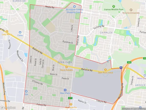
Deer Park Suburbs & Region, Deer Park Map & Postcodes
Deer Park Suburbs & Region, Deer Park Map & Postcodes in Deer Park, Brimbank, Melbourne West, VIC, AU
Deer Park Region
Region Name
Deer Park (VIC, AU)Deer Park Area
8.08 square kilometers (8.08 ㎢)Deer Park Introduction
Deer Park is a suburb in Melbourne, Victoria, Australia. It is located 10 km west of Melbourne's central business district (CBD). The suburb is named after Deer Park, which was a large area of land that was used for deer hunting in the early 1900s. Deer Park has a variety of housing styles, including single-family homes, apartments, and townhouses. The suburb has a number of parks and recreational facilities, including the Deer Park Reserve, which has a playground, walking trails, and a cricket pitch. The suburb is also home to a number of schools, including Deer Park Primary School and St. Joseph's College.Australia State
City or Big Region
Greater Capital City
Greater Melbourne (2GMEL)District or Regional Area
Suburb Name
Deer Park Suburbs
Deer Park full address
Deer Park, Brimbank, Melbourne West, Victoria, VIC, Australia, SaCode: 213011569Country
Deer Park, Brimbank, Melbourne West, Victoria, VIC, Australia, SaCode: 213011569
Deer Park Suburbs & Region, Deer Park Map & Postcodes has 0 areas or regions above, and there are 0 Deer Park suburbs below. The sa2code for the Deer Park region is 213011569. Deer Park area belongs to Australia's greater capital city Greater Melbourne.
