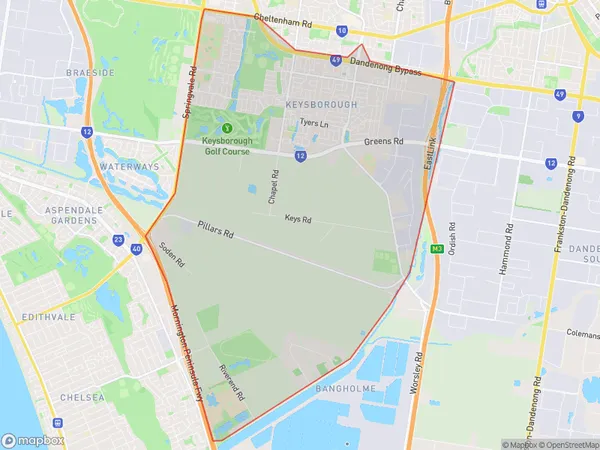
Keysborough South Suburbs & Region, Keysborough South Map & Postcodes
Keysborough South Suburbs & Region, Keysborough South Map & Postcodes in Keysborough South, Dandenong, Melbourne South East, VIC, AU
Keysborough South Region
Region Name
Keysborough South (VIC, AU)Keysborough South Area
23.67 square kilometers (23.67 ㎢)Keysborough South Introduction
Keysborough South is a suburb in Melbourne's south-east, 10 km south-east of Melbourne's central business district. It is represented by the Legislative Assembly of Victoria as the Division of Keysborough. At the 2016 census, Keysborough South had a population of 11,055. The suburb has a variety of shops, restaurants, and parks, including Keysborough Reserve, which has a playground, cricket nets, and a basketball court. The suburb is also home to several schools, including Keysborough Secondary College and St Francis of Assisi Catholic Primary School. Keysborough South is well-connected to the rest of Melbourne, with easy access to the Monash Freeway and the EastLink tollway. It is also a short drive to the beach and the Dandenong Ranges.Australia State
City or Big Region
Greater Capital City
Greater Melbourne (2GMEL)District or Regional Area
Suburb Name
Keysborough South Suburbs
Keysborough South full address
Keysborough South, Dandenong, Melbourne South East, Victoria, VIC, Australia, SaCode: 212041566Country
Keysborough South, Dandenong, Melbourne South East, Victoria, VIC, Australia, SaCode: 212041566
Keysborough South Suburbs & Region, Keysborough South Map & Postcodes has 0 areas or regions above, and there are 0 Keysborough South suburbs below. The sa2code for the Keysborough South region is 212041566. Keysborough South area belongs to Australia's greater capital city Greater Melbourne.
