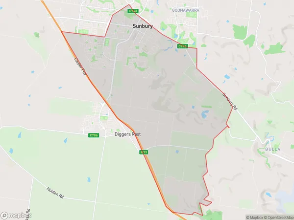
Sunbury South Suburbs & Region, Sunbury South Map & Postcodes
Sunbury South Suburbs & Region, Sunbury South Map & Postcodes in Sunbury South, Sunbury, Melbourne North West, VIC, AU
Sunbury South Region
Region Name
Sunbury South (VIC, AU)Sunbury South Area
41.45 square kilometers (41.45 ㎢)Sunbury South Introduction
Sunbury South is a suburb in Melbourne's north-west, 11 kilometers from the city center. It is part of the City of Hume local government area. The post office opened as Sunbury on 1 October 1889 and was closed on 1 March 1971. The suburb has a primary school and a secondary college. Sunbury South has a variety of shops and restaurants and is home to a large number of families. The suburb is well-connected to public transport, with buses and trains running regularly.Australia State
City or Big Region
Greater Capital City
Greater Melbourne (2GMEL)District or Regional Area
Suburb Name
Sunbury South Suburbs
Sunbury South full address
Sunbury South, Sunbury, Melbourne North West, Victoria, VIC, Australia, SaCode: 210041540Country
Sunbury South, Sunbury, Melbourne North West, Victoria, VIC, Australia, SaCode: 210041540
Sunbury South Suburbs & Region, Sunbury South Map & Postcodes has 0 areas or regions above, and there are 0 Sunbury South suburbs below. The sa2code for the Sunbury South region is 210041540. Sunbury South area belongs to Australia's greater capital city Greater Melbourne.
