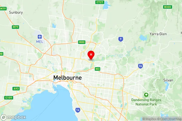
Heidelberg Rosanna Suburbs & Region, Heidelberg Rosanna Map & Postcodes
Heidelberg Rosanna Suburbs & Region, Heidelberg Rosanna Map & Postcodes in Heidelberg Rosanna, Banyule, Melbourne North East, VIC, AU
Heidelberg Rosanna Region
Region Name
Heidelberg Rosanna (VIC, AU)Heidelberg Rosanna Area
6.37 square kilometers (6.37 ㎢)Postal Codes
3084 (In total, there are 1 postcodes in Heidelberg Rosanna.)Heidelberg Rosanna Introduction
Heidelberg Rosanna is a suburb located in the northern suburbs of Melbourne, Victoria, Australia. It is 11 kilometers north-east of Melbourne's central business district (CBD). The suburb is named after the German city of Heidelberg, which is famous for its university and the Heidelberg Palace. Heidelberg Rosanna is a well-established suburb with a variety of housing options, including single-family homes, apartments, and townhouses. The suburb has a mix of older and newer properties, with many of the homes built in the 1950s and 1960s. The suburb is known for its peaceful and quiet atmosphere, with plenty of parks and green spaces. Heidelberg Rosanna is well-connected to the rest of Melbourne, with easy access to the city's major road networks, including the Eastern Freeway and the Monash Freeway. The suburb also has a train station, with regular services to the CBD and other parts of the city. The suburb has a variety of shopping options, including a large supermarket, a variety of specialty stores, and a number of cafes and restaurants. There are also several medical facilities, including a hospital and a number of medical clinics. Heidelberg Rosanna is a popular suburb for families, with a number of schools and child care facilities. The suburb also has a number of community facilities, including a community center, a library, andAustralia State
City or Big Region
Greater Capital City
Greater Melbourne (2GMEL)District or Regional Area
Suburb Name
Heidelberg Rosanna Region Map

Heidelberg Rosanna Postcodes / Zip Codes
Heidelberg Rosanna Suburbs
Heidelberg Rosanna full address
Heidelberg Rosanna, Banyule, Melbourne North East, Victoria, VIC, Australia, SaCode: 209011198Country
Heidelberg Rosanna, Banyule, Melbourne North East, Victoria, VIC, Australia, SaCode: 209011198
Heidelberg Rosanna Suburbs & Region, Heidelberg Rosanna Map & Postcodes has 0 areas or regions above, and there are 3 Heidelberg Rosanna suburbs below. The sa2code for the Heidelberg Rosanna region is 209011198. Its latitude and longitude coordinates are -37.7527,145.07. Heidelberg Rosanna area belongs to Australia's greater capital city Greater Melbourne.
Heidelberg Rosanna Suburbs & Localities
1. Banyule
2. Heidelberg
3. Rosanna
