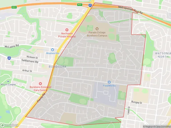
Bundoora East Suburbs & Region, Bundoora East Map & Postcodes
Bundoora East Suburbs & Region, Bundoora East Map & Postcodes in Bundoora East, Banyule, Melbourne North East, VIC, AU
Bundoora East Region
Region Name
Bundoora East (VIC, AU)Bundoora East Area
4.07 square kilometers (4.07 ㎢)Bundoora East Introduction
Bundoora East is a suburb in Melbourne's north-east, 10 kilometers north-east of Melbourne's central business district. It is represented by the Legislative Assembly of Victoria's Legislative Council of Victoria as part of the North East Province. The suburb is named after the Bundoora Park Racecourse, which was established in 1861. Bundoora East has a variety of shops, including a large supermarket, a variety of specialty stores, and several cafes and restaurants. There are also several parks and recreational facilities, including the Bundoora Park Golf Course and the Bundoora Park Tennis Club. The suburb is well-connected to public transport, with several bus routes and a train station located within walking distance. The population of Bundoora East is approximately 11,000 people, with a majority of residents being of European descent. The suburb has a low crime rate and is considered a safe and desirable place to live.Australia State
City or Big Region
Greater Capital City
Greater Melbourne (2GMEL)District or Regional Area
Suburb Name
Bundoora East Suburbs
Bundoora East full address
Bundoora East, Banyule, Melbourne North East, Victoria, VIC, Australia, SaCode: 209011196Country
Bundoora East, Banyule, Melbourne North East, Victoria, VIC, Australia, SaCode: 209011196
Bundoora East Suburbs & Region, Bundoora East Map & Postcodes has 0 areas or regions above, and there are 0 Bundoora East suburbs below. The sa2code for the Bundoora East region is 209011196. Bundoora East area belongs to Australia's greater capital city Greater Melbourne.
