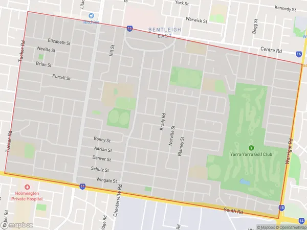
Bentleigh East South Suburbs & Region, Bentleigh East South Map & Postcodes
Bentleigh East South Suburbs & Region, Bentleigh East South Map & Postcodes in Bentleigh East South, Glen Eira, Melbourne Inner South, VIC, AU
Bentleigh East South Region
Region Name
Bentleigh East South (VIC, AU)Bentleigh East South Area
4.59 square kilometers (4.59 ㎢)Bentleigh East South Introduction
Bentleigh East South is a suburb in Melbourne, Victoria, Australia. It is located 10 kilometers south-east of Melbourne's central business district and is part of the City of Bayside. The suburb has a population of around 10,000 people and is known for its high-quality housing, leafy streets, and excellent public transport links. Bentleigh East South is home to a variety of shops, restaurants, and cafes, as well as several parks and recreational facilities, including Bentleigh East Park and the Bentleigh East Golf Club. The suburb is also well-connected to other parts of Melbourne, with easy access to the Monash Freeway and the EastLink tollway.Australia State
City or Big Region
Greater Capital City
Greater Melbourne (2GMEL)District or Regional Area
Suburb Name
Bentleigh East South Suburbs
Bentleigh East South full address
Bentleigh East South, Glen Eira, Melbourne Inner South, Victoria, VIC, Australia, SaCode: 208021427Country
Bentleigh East South, Glen Eira, Melbourne Inner South, Victoria, VIC, Australia, SaCode: 208021427
Bentleigh East South Suburbs & Region, Bentleigh East South Map & Postcodes has 0 areas or regions above, and there are 0 Bentleigh East South suburbs below. The sa2code for the Bentleigh East South region is 208021427. Bentleigh East South area belongs to Australia's greater capital city Greater Melbourne.
